Bilder
Videos
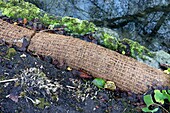
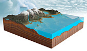
13525430 - Reconstruction of eroded bank

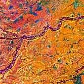
13671948 - Chongqing, China, satellite image
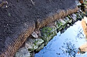
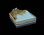
13525426 - Reconstruction of eroded bank

13525431 - Reconstruction of eroded bank
12987300 - European Upper Palaeolithic glaciation, illustration
13243574 - Puijila walking seal, illustration
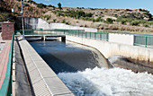
13417119 - Delivery Tunnel North Lesotho Highlands Water Project
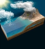
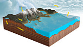
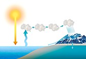
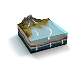
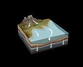
13297809 - Water cycle, illustration
13525428 - Reconstruction of eroded bank
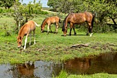
13404444 - New forest ponies grazing
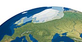
12987301 - European Upper Palaeolithic glaciation, illustration
12655897 - Cyber-physical networked systems, illustration
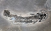
12987068 - Gyroptychius fossil

12971797 - Prehistoric Doggerland region, illustration
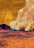
12961755 - Dust storm on Titan,illustration
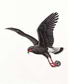
13499335 - Snail kite, illustration
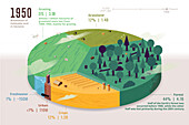
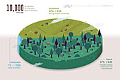
13744020 - Habitable land by type in 1950, illustration

12987302 - European Upper Palaeolithic glaciation, illustration

13743878 - Types of river transportation, illustration
12961734 - Somme River and WWI battlefields,satellite image
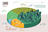
13744019 - Habitable land by type in 1900, illustration
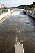
13417120 - Delivery Tunnel North Lesotho Highlands Water Project
13744015 - Habitable land by type, 10, 000 years ago, illustration
12647133 - Adams Falls

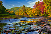
12644743 - Brodhead Creek
12644730 - Delaware River

13417229 - The Himalayas from space
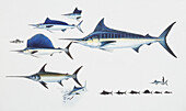
13471863 - Striped marlin, illustration
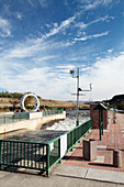
13417121 - Delivery Tunnel North Lesotho Highlands Water Project

12991444 - Connected Earth systems, illustration
12651319 - Warnertown Falls
12647132 - Shanty Run

13744017 - Habitable land by type in 1700, illustration

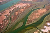
12582187 - Estuarine marshland channels, aerial photograph
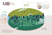
13744016 - Habitable land by type, 5, 000 years ago, illustration
12644749 - Lava Creek Falls
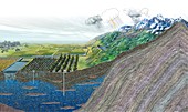
12492771 - Formation of sedimentary rock, illustration
12492568 - Formation of sedimentary rock, illustration
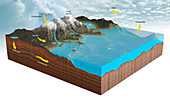
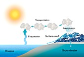
13417899 - Water cycle, illustration
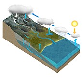
12553527 - Water cycle, illustration
12331948 - Nile and Egyptian desert, satellite image
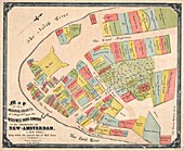
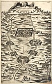
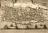
12450108 - Property map for New Amsterdam, 1642
13417901 - Water cycle, illustration
12647131 - Kettle Creek
12492569 - Formation of sedimentary rock, illustration
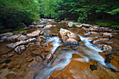
12647128 - Shanty Run

12420762 - Trash collects on Ballona Creek after rainfall
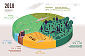
13744021 - Habitable land by type in 2018, illustration
12644731 - Delaware River
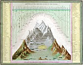
12582086 - Rivers and mountains of the world, 1840s
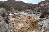
13955312 - Flash flood, Wadi Tzeelim, Negev Desert, Israel
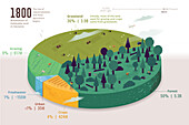
13744018 - Habitable land by type in 1800, illustration
12650577 - Pinnacle Ledge

12644716 - Choke Creek Falls
12582186 - Estuarine marshland channels, aerial photograph
12646702 - Shohola Creek Gorge
13417900 - Water cycle, illustration

12644739 - Buttermilk Falls
13955311 - Flash flood, Wadi Tzeelim, Negev Desert, Israel
12420477 - Marshes, aerial photograph
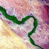
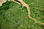
12331956 - Meta River and tropical grasslands, satellite image
12582188 - Estuarine marshland channels, aerial photograph
11728272 - Water cycle,illustration
11728270 - Water cycle,illustration

11727756 - Map of China,17th century
12644729 - Delaware River
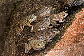
12638561 - Lowland Leopard Frog
12492567 - Formation of sedimentary rock, illustration

12325544 - Northeastern Iran, satellite image

11959321 - Selune estuary and countryside,France

11698116 - Khartoum,Sudan,satellite image
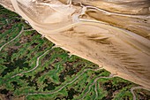
12582189 - Estuarine marshland channels, aerial photograph

12331945 - Yukon Delta, satellite image

12248785 - New York City, satellite image

11731337 - Earth's water resources,illustration
12450021 - Cities of Babylon and Nineveh, 17th-century illustration

12420760 - Trash collects on Ballona Creek after rainfall
11730816 - Lisbon as New Amsterdam,17th century
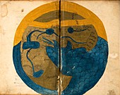
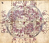
11703544 - Islamic map of the world,13th century

12644728 - Dingmans Ferry Bridge

12639440 - Kayaking on the Delaware River
12492770 - Formation of sedimentary rock, illustration
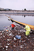
12420761 - Trash collects on Ballona Creek after rainfall
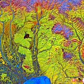
12331944 - Siberian rivers and Arctic delta, satellite image
11727684 - Korean world map,19th century
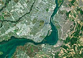
11712796 - Montreal,Canada,satellite image

12376949 - New Netherland, 17th century
12331954 - Ord River estuary, satellite image
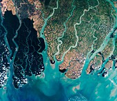
12325554 - Sundarbans, Bangladesh, satellite image
11731328 - Fresh water sources,illustration

12634458 - Brodhead Creek
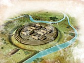
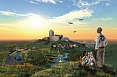
12451188 - Viking ring fortress, illustration
11729272 - Syltoppene,Greenland

12634443 - North Branch Susquehanna River

12492769 - Formation of sedimentary rock, illustration

11730216 - Buddhist world map,1710

11701806 - The sacrificed horse is prepared
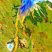
11688102 - Bitterroot Range-Yellowstone,ISS image
12644732 - Thomas Darling Preserve
nächste Seite
Flüsse Bilder ❘ Science Photo Library