Nile and Egyptian desert, satellite image
Bildnummer 12331948
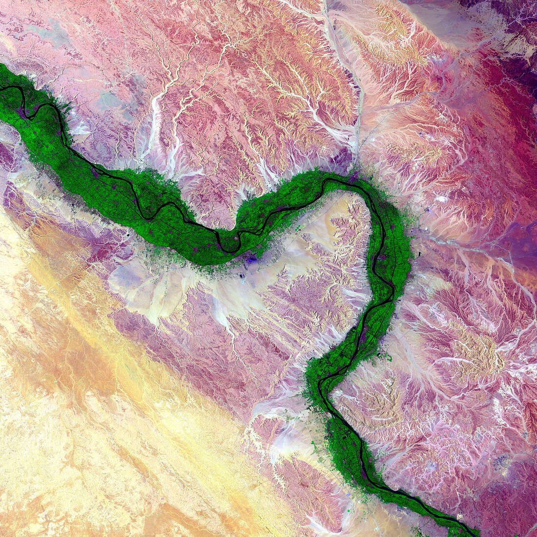
| Nile and Egyptian desert, satellite image. Along the Nile River in Egypt, farmland (green) is maintained on the river's floodplain in stark contrast to the surrounding arid desert. The ability to farm along this river has sustained civilisations in this area for thousands of years. This region of the river includes the city of Luxor and many of the famed structures and buildings of Ancient Egypt. Image data obtained by the Landsat 8 satellite on 15 August 2014. | |
| Lizenzart: | Lizenzpflichtig |
| Credit: | Science Photo Library / US Geological Survey |
| Bildgröße: | 4221 px × 4217 px |
| Modell-Rechte: | nicht erforderlich |
| Eigentums-Rechte: | nicht erforderlich |
| Restrictions: | - |
Preise für dieses Bild ab 15 €
Universitäten & Organisationen
(Informationsmaterial Digital, Informationsmaterial Print, Lehrmaterial Digital etc.)
ab 15 €
Redaktionell
(Bücher, Bücher: Sach- und Fachliteratur, Digitale Medien (redaktionell) etc.)
ab 30 €
Werbung
(Anzeigen, Aussenwerbung, Digitale Medien, Fernsehwerbung, Karten, Werbemittel, Zeitschriften etc.)
ab 55 €
Handelsprodukte
(bedruckte Textilie, Kalender, Postkarte, Grußkarte, Verpackung etc.)
ab 75 €
Pauschalpreise
Rechtepakete für die unbeschränkte Bildnutzung in Print oder Online
ab 495 €
Keywords
- 2014,
- 21. Jahrhundert,
- Ackerland,
- Afrika,
- Afrikanisch,
- Ägypten,
- Ägyptisch,
- bewässert,
- Bewässerung,
- Erdbeobachtung,
- Felder,
- Felsen,
- Fluss,
- Flüsse,
- geografisch,
- Geographie,
- Geologie,
- geologisch,
- Kontrast,
- Landsat 8,
- Landwirtschaft,
- landwirtschaftlich,
- Niemand,
- Sand,
- Satellit,
- Satellitenbild,
- Vegetation,
- Wasserweg,
- Weltall,
- Wüste