Sundarbans, Bangladesh, satellite image
Bildnummer 12325554
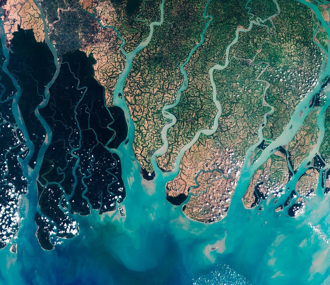
| Sundarbans. Satellite image centred over the very eastern part of the Sundarbans in Bangladesh. This region comprising southern Bangladesh and a small part of the Indian state of west Bengal. The whole area incorporates some 10 000 sq kilometres consisting of mangrove and swamp forests bordering the vast river delta on the Bay of Bengal (bottom). It is the world's largest single region of tidal halophytic mangrove forest. Here, the Sundarbans region appears in dark shades of green, while the adjacent brighter areas are densely populated and dominated by agriculture. Imaged by the Sentinel-2A satellite, on 18th March 2016. | |
| Lizenzart: | Lizenzpflichtig |
| Credit: | Science Photo Library / ESA / Copernicus Sentinel data (2016) |
| Bildgröße: | 6001 px × 5175 px |
| Modell-Rechte: | nicht erforderlich |
| Eigentums-Rechte: | nicht erforderlich |
| Restrictions: |
|
Preise für dieses Bild ab 15 €
Universitäten & Organisationen
(Informationsmaterial Digital, Informationsmaterial Print, Lehrmaterial Digital etc.)
ab 15 €
Redaktionell
(Bücher, Bücher: Sach- und Fachliteratur, Digitale Medien (redaktionell) etc.)
ab 30 €
Werbung
(Anzeigen, Aussenwerbung, Digitale Medien, Fernsehwerbung, Karten, Werbemittel, Zeitschriften etc.)
ab 55 €
Handelsprodukte
(bedruckte Textilie, Kalender, Postkarte, Grußkarte, Verpackung etc.)
ab 75 €
Pauschalpreise
Rechtepakete für die unbeschränkte Bildnutzung in Print oder Online
ab 495 €
Keywords
- 2016,
- 21. Jahrhundert,
- Asiatisch,
- Asien,
- Bauernhof,
- Bauernhöfe,
- Biologie,
- biologisch,
- Bodennutzung,
- Botanik,
- botanisch,
- Erdbeobachtung,
- Flüsse,
- Flut-,
- geografisch,
- Geographie,
- Golf von Bengalen,
- Halophyt,
- Indischer Ozean,
- Küste,
- Küsten-,
- Landwirtschaft,
- landwirtschaftlich,
- Mangrove,
- Niemand,
- Ökologie,
- Ökologisch,
- Pflanze,
- Pflanzen,
- Satellitenbild,
- Sumpf,
- System,
- Umwelt,
- Umweltwissenschaften,
- Vergleich,
- vergleichen,
- verglichen,
- Wald,
- Wälder,
- Weltall