Deforestation in Bolivia, satellite image
Bildnummer 13672372
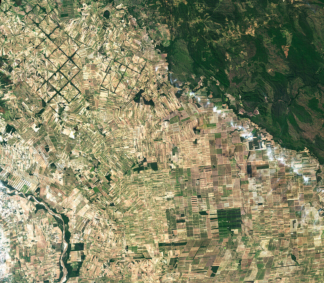
| Satellite image showing radial patterns of deforestation in Bolivia, where Chiquitano dry forests in Tierras Bajas region, east of Santa Cruz have been cleared for agricultural use. Since the 1980s, this region has been rapidly deforested due to the relatively flat lowlands and abundant rainfall that make it suitable for farming. Image obtained by the Operation Land Imager (OLI) on the Landsat 8 satellite on the 22nd of August 2022. | |
| Lizenzart: | Lizenzpflichtig |
| Credit: | Science Photo Library / NASA |
| Bildgröße: | 3448 px × 3008 px |
| Modell-Rechte: | nicht erforderlich |
| Eigentums-Rechte: | nicht erforderlich |
| Restrictions: | - |
Preise für dieses Bild ab 15 €
Universitäten & Organisationen
(Informationsmaterial Digital, Informationsmaterial Print, Lehrmaterial Digital etc.)
ab 15 €
Redaktionell
(Bücher, Bücher: Sach- und Fachliteratur, Digitale Medien (redaktionell) etc.)
ab 30 €
Werbung
(Anzeigen, Aussenwerbung, Digitale Medien, Fernsehwerbung, Karten, Werbemittel, Zeitschriften etc.)
ab 55 €
Handelsprodukte
(bedruckte Textilie, Kalender, Postkarte, Grußkarte, Verpackung etc.)
ab 75 €
Pauschalpreise
Rechtepakete für die unbeschränkte Bildnutzung in Print oder Online
ab 495 €