Bilder
Videos
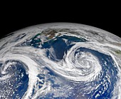
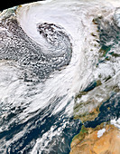
11694258 - Clouds over Gulf of Alaska,MODIS image

11690130 - Iberian Peninsula,MODIS image
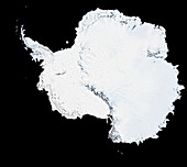
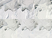
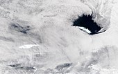
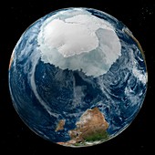
11600040 - Antarctica,MODIS image

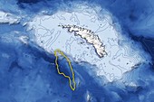
13524299 - Madagascar, satellite image
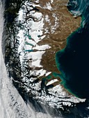
13378123 - Iceberg A68a approaching South Georgia
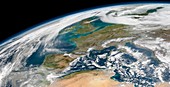
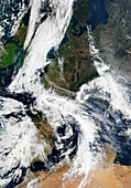
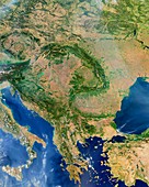
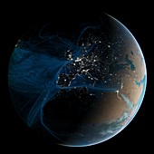
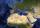
13405744 - Western Europe, satellite image
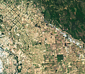
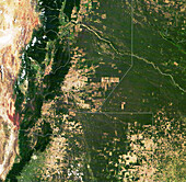
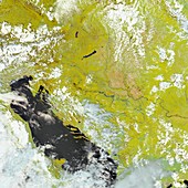
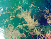
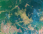
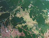
13672372 - Deforestation in Bolivia, satellite image

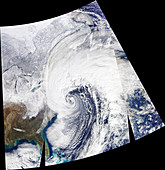
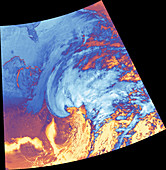
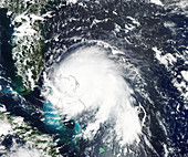
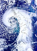
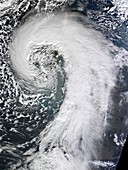
13387115 - Storm Christoph approaching UK, satellite image
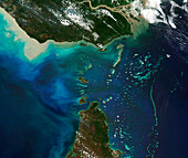
13445270 - Torres strait, satellite image
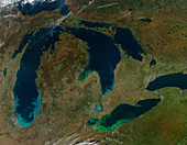
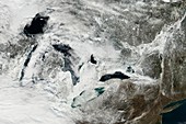
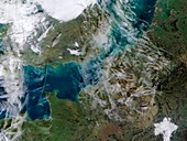
13405711 - Sediment and algae, Great Lakes, USA, satellite image
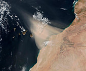
13297824 - Dust storm over the Canary Islands, satellite image
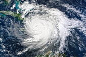
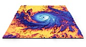
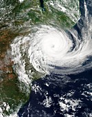
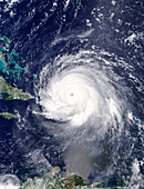
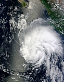
13524617 - Hurricane Matthew, satellite image
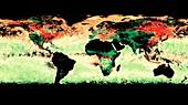
13470836 - Map of actively burning fires around the world, May 2021
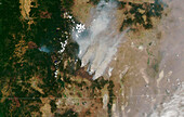
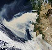
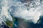
13444861 - Oregon wildfires, July 2021
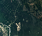
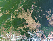
13672373 - Deforestation in Tierra Bajas, Bolivia, satellite image

13445274 - Deforestation in Gran Chaco, Argentina, satellite image
12960872 - Storm Brendan,January 2020
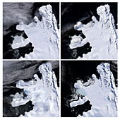
12959821 - Antarctic ice shelf calving sequence,September 2019
12960631 - 2019-20 Australian bushfire season,satellite image
12919503 - Amazon fire detections using satellite data, August 2019
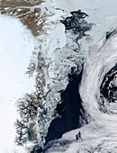
13297956 - Iceberg A68a approaching South Georgia, satellite image
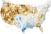
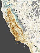
13435643 - Western USA drought, June 2021
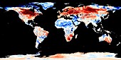
12961545 - 2018 European heatwave,temperature anomaly map

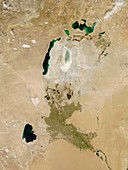
11692476 - Aral Sea,satellite image,2014

13455042 - Hurricane Ida, satellite image

12961506 - Red tide algal bloom along the Florida coastline
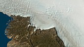
12959822 - Hiawatha glacier and crater in Greenland,satellite image
12919498 - Deforestation in the Amazon, June 2019
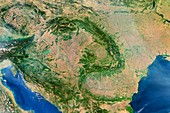
12493186 - Pannonian Basin, satellite image
12446494 - US East coast bomb cyclone, 2018, satellite image
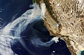
13355471 - US Pacific Coast wildfires, September 2020

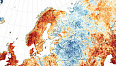
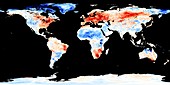
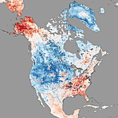
12916562 - European temperature anomalies, February 2019
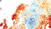
12583201 - Scandinavian heat wave, July 2018, satellite image
12446493 - US East coast bomb cyclone, 2018, satellite image
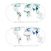
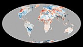
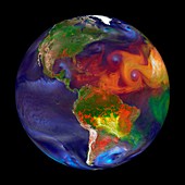
13417311 - Maps showing vegetation cover offsetting global warming
12582435 - Wildfires, California, USA, November 2018
13445275 - Deforestation in Gran Chaco, Argentina, satellite image
12959823 - Hiawatha glacier and crater in Greenland,satellite image
13355786 - US Pacific Coast wildfires, September 2020

12961062 - Storm Gloria,January 2020
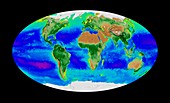
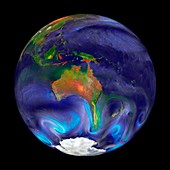
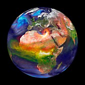
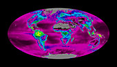
12582897 - Global biosphere, October 1997
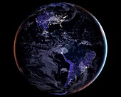
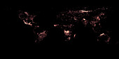
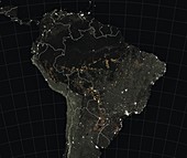
12395327 - Americas at night, satellite image
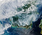
12949160 - Smoke from Indonesian fires, satellite image
12395502 - Hurricane Maria, thermal satellite image
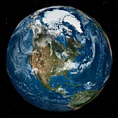
12393773 - Arctic and North America, satellite image
12917789 - Cyclone Idai landfall in Mozambique, 14 March 2019
12947539 - Hurricane Dorian over the Bahamas, satellite image
12632796 - Ice Shelf Disintegrating, Spring 2008

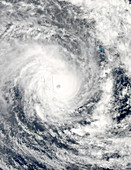
11703077 - Tropical Cyclone Cristina,2014
11727788 - Global fires,GEOS simulation
11698123 - South American winter,satellite image

11697796 - North America at night
11697649 - Frozen Great Lakes,2014,satellite image
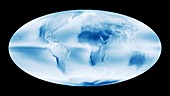
11727817 - Global cloud map

11698114 - Kamchatka Peninsula phytoplankton bloom
12581415 - Storm Leslie, October 2018
12493185 - Central Europe, satellite image

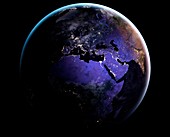
12395328 - Europe and Africa at night, satellite image
11730840 - Global warming record,December 2015

11730839 - Global warming record,December 2015
11701557 - 2014 California drought,satellite map

12378918 - Hurricane Harvey over Texas, USA, satellite image
11674822 - Low pressure over the UK 12 February 2014
11697795 - Europe and north Africa at night

12582898 - Global biosphere, October 1997
12393774 - Antarctica and southern Africa, satellite image
11727786 - Global fires,GEOS simulation
12395326 - Asia at night, satellite image
11727871 - Melting Arctic sea ice,July 2015
11727818 - Global temperature anomalies,2015
11727815 - Indonesian forest fires,2015
11698974 - Contrails over the English Channel
11727816 - Ocean chlorophyll concentrations,2015
11679139 - Aral sea,2013
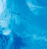
12376516 - Larsen C iceberg, satellite image
11697651 - North America temperatures,December 2013

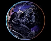
11697797 - Asia at night
11694264 - Flooding in the Balkans,satellite image

12325239 - Cyclone Debbie off Australian coast
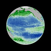
11696026 - Global productivity levels,satellite map

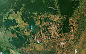
11683825 - Deforestation in the Amazon,2000
12395104 - Hurricane Irma, satellite image
11730838 - Global warming record,December 2015
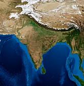
11729382 - India,topographic and bathymetric map
11683835 - Deforestation in the Amazon,2011

11697648 - Frozen Great Lakes,2014,satellite image
11683832 - Deforestation in the Amazon,2006
11672802 - Europe,topographic and bathymetric map
11686337 - Tropical storm Hernan,2014
11723568 - Atmospheric aerosol distribution,2015
12395329 - Eurasia and Africa at night, satellite image
11703674 - Cyclone Pam over Vanuatu,13 March 2015
11727783 - Global fires,GEOS simulation
11683829 - Deforestation in the Amazon,2003
11701561 - Extratropical cyclone,UK,February 2014
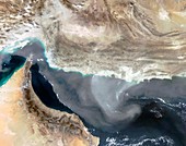
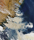
11688199 - Dust storm over Iran,satellite image
11683836 - Deforestation in the Amazon,2012

11683830 - Deforestation in the Amazon,2004
12257712 - Global burned areas, satellite map
nächste Seite
Modis Bilder ❘ Science Photo Library