US Pacific Coast wildfires, September 2020
Bildnummer 13355471
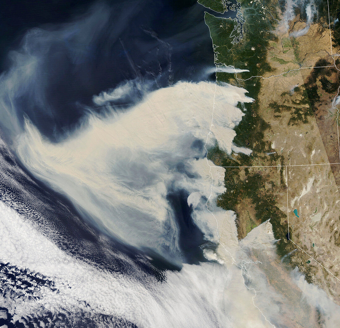
| Satellite image of smoke from wildfires along the pacific coast of the USA. The smoke is being drawn westward by powerful dry downslope winds that are fanning the fires. Since mid-August millions of acres have burned on the Pacific coast, destroying thousands of homes and killing dozens of people. Data obtained by the Moderate Resolution Imaging Spectroradiometer (MODIS) on NASA’s Aqua satellite on 8th September 2020. | |
| Lizenzart: | Lizenzpflichtig |
| Credit: | Science Photo Library / NASA |
| Bildgröße: | 3100 px × 2986 px |
| Modell-Rechte: | nicht erforderlich |
| Eigentums-Rechte: | nicht erforderlich |
| Restrictions: | - |
Preise für dieses Bild ab 15 €
Universitäten & Organisationen
(Informationsmaterial Digital, Informationsmaterial Print, Lehrmaterial Digital etc.)
ab 15 €
Redaktionell
(Bücher, Bücher: Sach- und Fachliteratur, Digitale Medien (redaktionell) etc.)
ab 30 €
Werbung
(Anzeigen, Aussenwerbung, Digitale Medien, Fernsehwerbung, Karten, Werbemittel, Zeitschriften etc.)
ab 55 €
Handelsprodukte
(bedruckte Textilie, Kalender, Postkarte, Grußkarte, Verpackung etc.)
ab 75 €
Pauschalpreise
Rechtepakete für die unbeschränkte Bildnutzung in Print oder Online
ab 495 €
Keywords
- 2000er Jahre,
- 21. Jahrhundert,
- aqua,
- Atmosphäre,
- atmosphärisch,
- Feuer,
- Globale Erwärmung,
- Kalifornien,
- Klimatologie,
- klimatologisch,
- Klimawandel,
- Küste,
- modis,
- Naturkatastrophe,
- Niemand,
- Nordamerika,
- nordamerikanisch,
- Oregon,
- Pazifik,
- Rauch,
- Satellitenbild,
- Umwelt,
- USA,
- Vereinigte Staaten,
- Verschmutzung,
- Weltall