Hurricane Emily,16 July 2005
Bildnummer 11738038
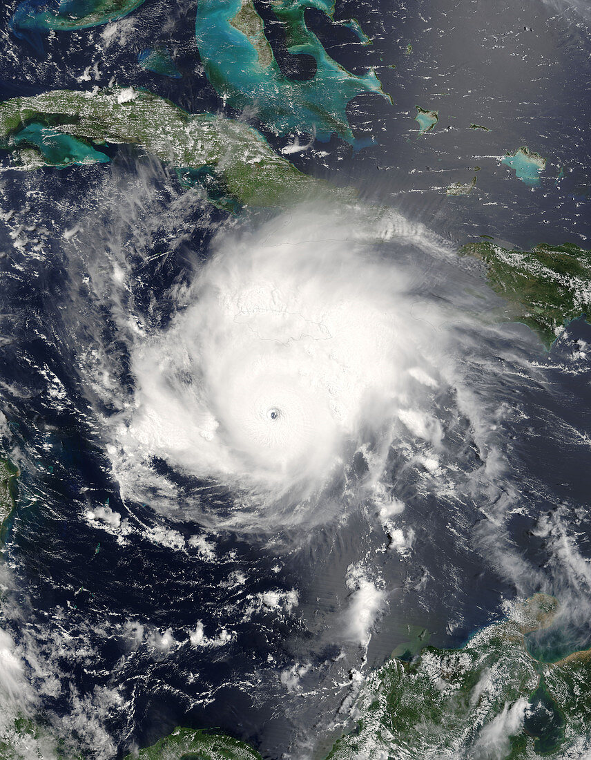
| Hurricane Emily. Satellite image of Hurricane Emily (centre) passing south of the island of Jamaica in the Caribbean Sea on 16 July 2005 at 1545 GMT. Emily is the second hurricane in a week to pass by Jamaica,causing flooding and deaths. Cuba is just above the hurricane. Haiti and Dominican Republic are on the right. Below the hurricane are parts of Panama,Colombia and Venezuela. Hurricanes are enormous rotating storm systems in which winds can reach over 240 kph. At the time this image was taken,Emily was classified as a borderline category 4/5 hurricane,producing winds of 249 kilometres per hour. Image taken by the MODIS instrument on board NASA's Terra satellite | |
| Lizenzart: | Lizenzpflichtig |
| Credit: | Science Photo Library / NASA |
| Bildgröße: | 4000 px × 5143 px |
| Modell-Rechte: | nicht erforderlich |
| Eigentums-Rechte: | nicht erforderlich |
| Restrictions: | - |
Preise für dieses Bild ab 15 €
Universitäten & Organisationen
(Informationsmaterial Digital, Informationsmaterial Print, Lehrmaterial Digital etc.)
ab 15 €
Redaktionell
(Bücher, Bücher: Sach- und Fachliteratur, Digitale Medien (redaktionell) etc.)
ab 30 €
Werbung
(Anzeigen, Aussenwerbung, Digitale Medien, Fernsehwerbung, Karten, Werbemittel, Zeitschriften etc.)
ab 55 €
Handelsprodukte
(bedruckte Textilie, Kalender, Postkarte, Grußkarte, Verpackung etc.)
ab 75 €
Pauschalpreise
Rechtepakete für die unbeschränkte Bildnutzung in Print oder Online
ab 495 €