Flooded Indus River,Pakistan
Bildnummer 11589506
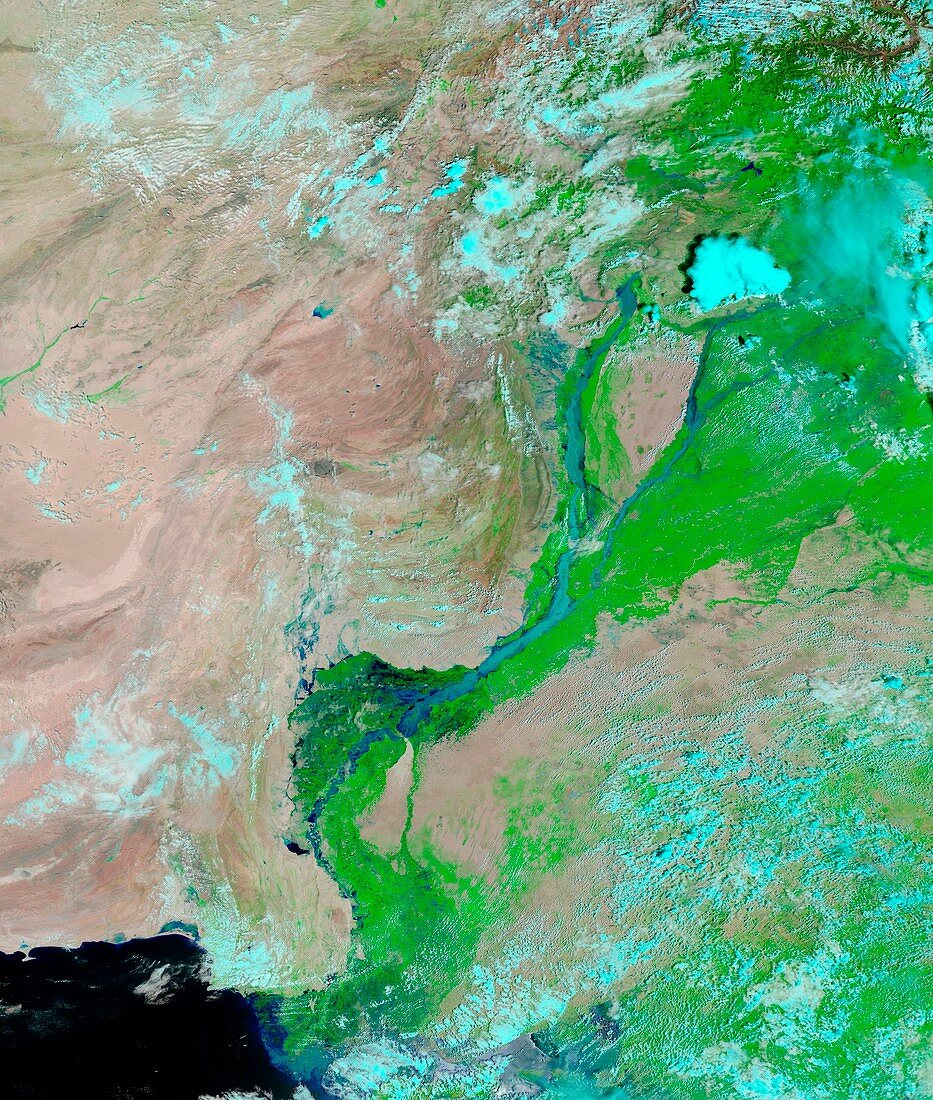
| Flooded Indus River. Satellite image showing the course of the Indus River in northwestern Pakistan,two weeks into the worst Monsoon flooding since 1929. Water varies in colour from electric blue to navy. Vegetation is green and bare ground is pinkish brown. Clouds range from nearly white to pale blue-green. Flowing roughly north-south the water level is high enough to cover areas that were dry the previous year (see image: C007/1026) and is significantly higher than only 10 days previous (see image:C007/1029). Imaged by the MODIS (Moderate Resolution Imaging Spectroradiometer) onboard NASA's Terra satellite,on 11th August 2010 | |
| Lizenzart: | Lizenzpflichtig |
| Credit: | Science Photo Library / NASA |
| Bildgröße: | 4249 px × 5008 px |
| Modell-Rechte: | nicht erforderlich |
| Eigentums-Rechte: | nicht erforderlich |
| Restrictions: | - |
Preise für dieses Bild ab 15 €
Universitäten & Organisationen
(Informationsmaterial Digital, Informationsmaterial Print, Lehrmaterial Digital etc.)
ab 15 €
Redaktionell
(Bücher, Bücher: Sach- und Fachliteratur, Digitale Medien (redaktionell) etc.)
ab 30 €
Werbung
(Anzeigen, Aussenwerbung, Digitale Medien, Fernsehwerbung, Karten, Werbemittel, Zeitschriften etc.)
ab 55 €
Handelsprodukte
(bedruckte Textilie, Kalender, Postkarte, Grußkarte, Verpackung etc.)
ab 75 €
Pauschalpreise
Rechtepakete für die unbeschränkte Bildnutzung in Print oder Online
ab 495 €
Keywords
- 2010,
- 21. Jahrhundert,
- Asien,
- Boden,
- Erdbeobachtung,
- Fluss,
- Flut,
- geografisch,
- Geographie,
- Geologie,
- geologisch,
- hoch,
- Hydrologie,
- Klimatologie,
- klimatologisch,
- Kurs,
- Meteorologie,
- meteorologisch,
- modis,
- Pakistan,
- Route,
- Satellit,
- Satellitenbild,
- Südasien,
- Tal,
- Terra satellit,
- überflutet,
- Überschwemmung,
- Umwelt,
- Umweltwissenschaften,
- Wasser,
- Weltall,
- Wetter,
- Wolke,
- Wolken