Hurricane Erin,3-D computer image
Bildnummer 11562319
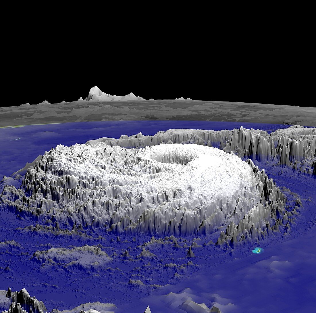
| Hurricane Erin. 3-D computer image of Hurricane Erin on 10th September 2001. The clouds were measured by infrared detectors aboard the Geostationary Operational Environmental Satellite (GOES) and the Tropical Rainfall Measuring Mission (TRMM) satellite. The background data is from the Moderate Resolution Imaging Spectroradiometer (MODIS) satellite. This data was processed by supercomputers at NASA to produce a 3-D animation | |
| Lizenzart: | Lizenzpflichtig |
| Credit: | Science Photo Library / NASA |
| Bildgröße: | 2560 px × 2534 px |
| Modell-Rechte: | nicht erforderlich |
| Eigentums-Rechte: | nicht erforderlich |
| Restrictions: | - |
Preise für dieses Bild ab 15 €
Universitäten & Organisationen
(Informationsmaterial Digital, Informationsmaterial Print, Lehrmaterial Digital etc.)
ab 15 €
Redaktionell
(Bücher, Bücher: Sach- und Fachliteratur, Digitale Medien (redaktionell) etc.)
ab 30 €
Werbung
(Anzeigen, Aussenwerbung, Digitale Medien, Fernsehwerbung, Karten, Werbemittel, Zeitschriften etc.)
ab 55 €
Handelsprodukte
(bedruckte Textilie, Kalender, Postkarte, Grußkarte, Verpackung etc.)
ab 75 €
Pauschalpreise
Rechtepakete für die unbeschränkte Bildnutzung in Print oder Online
ab 495 €
Keywords
- 21. Jahrhundert,
- 3-d,
- 3D,
- 3D-Modell,
- Amerikanisch,
- Computervisualisierung,
- Erdbeobachtung,
- extremes Wetter,
- Hurrikan,
- infrarot,
- ir,
- Klimatologie,
- klimatologisch,
- Meteorologie,
- meteorologisch,
- modis,
- NASA,
- Naturkatastrophe,
- Nordamerika,
- Ozean,
- Raum,
- Regen,
- Satellit,
- Satellitenbild,
- Supercomputersimulation,
- TRMM,
- USA,
- Vereinigte Staaten,
- Weltraumflug,
- Wetter,
- Wolke,
- Zyklon