Antarctic sea ice, August 2023
Bildnummer 13951830
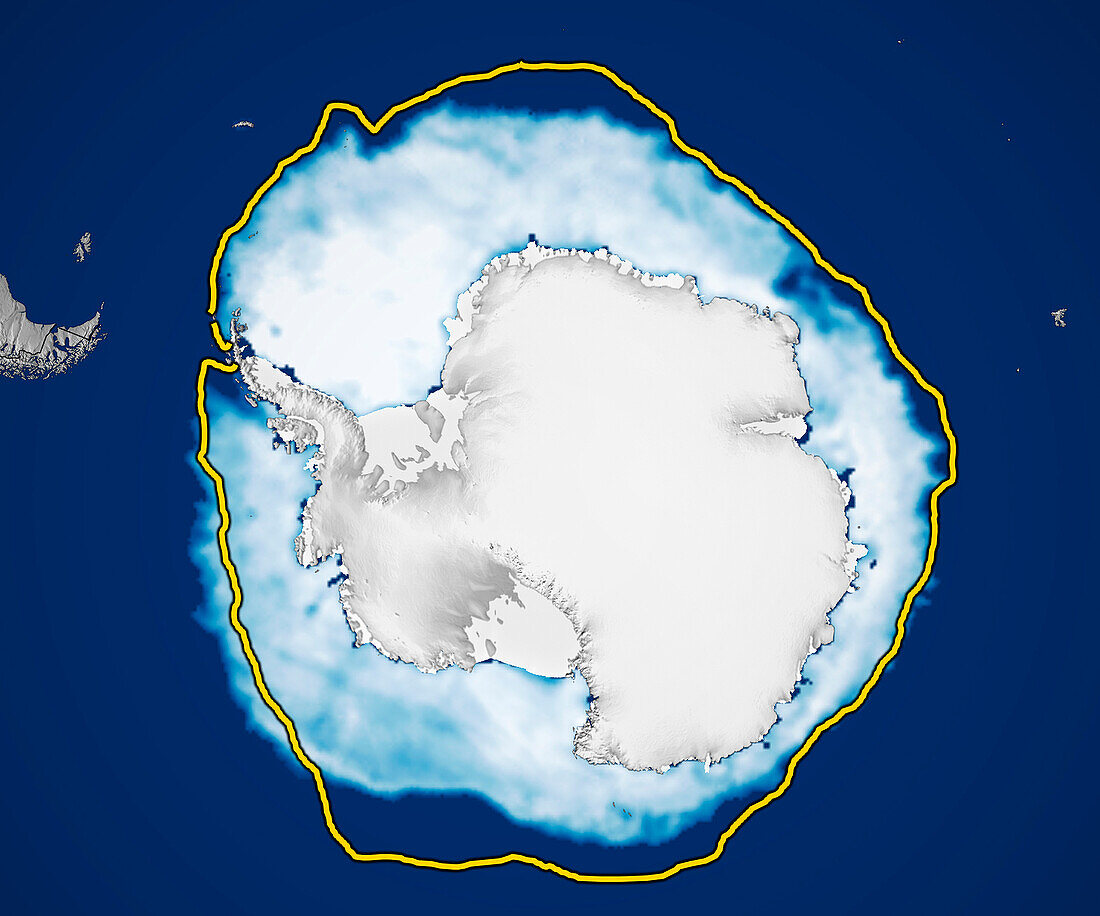
| Satellite image showing Antarctic sea ice on 7th August 2023. The yellow line shows the median July ice cover for the years 1981 to 2010. At 13.5 million square kilometres, this was the lowest extent ever recorded at this time of year. This decline follows a downward trend that started after a record high in 2014. The exact mechanism for this decline is not known, although it may be due to heating of the ocean around Antarctica. Data from microwave sensors (SSM/I and SSMIS) on Defense Meteorological Satellite Program (DMSP) satellites and the Scanning Multichannel Microwave Radiometer (SMMR) on the Nimbus-7 satellite. | |
| Lizenzart: | Lizenzpflichtig |
| Credit: | Science Photo Library / NSIDC, NASA |
| Bildgröße: | 3200 px × 2666 px |
| Modell-Rechte: | nicht erforderlich |
| Eigentums-Rechte: | nicht erforderlich |
| Restrictions: | - |
Preise für dieses Bild ab 15 €
Universitäten & Organisationen
(Informationsmaterial Digital, Informationsmaterial Print, Lehrmaterial Digital etc.)
ab 15 €
Redaktionell
(Bücher, Bücher: Sach- und Fachliteratur, Digitale Medien (redaktionell) etc.)
ab 30 €
Werbung
(Anzeigen, Aussenwerbung, Digitale Medien, Fernsehwerbung, Karten, Werbemittel, Zeitschriften etc.)
ab 55 €
Handelsprodukte
(bedruckte Textilie, Kalender, Postkarte, Grußkarte, Verpackung etc.)
ab 75 €
Pauschalpreise
Rechtepakete für die unbeschränkte Bildnutzung in Print oder Online
ab 495 €