Antarctic sea ice minimum extent, 2022
Bildnummer 13601185
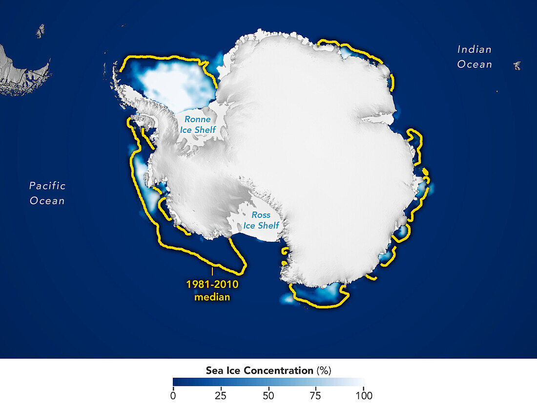
| Satellite image showing Antarctic sea ice at its annual minimum extent on 25th February 2022. The yellow line shows the median minimum extent for the years 1981 to 2010. The Antarctic sea ice reaches a minimum in late February, at the end of the Antarctic summer. At 1.92 million square kilometres, this was the lowest extent ever recorded. This decline is thought to be due to an earlier maximum extent in 2021 and strong winds that pushed the ice into warmer waters. Data from microwave sensors (SSM/I and SSMIS) on Defense Meteorological Satellite Program (DMSP) satellites and the Scanning Multichannel Microwave Radiometer (SMMR) on the Nimbus-7 satellite. | |
| Lizenzart: | Lizenzpflichtig |
| Credit: | Science Photo Library / National Snow and Ice Data Center / NASA Earth Observatory |
| Bildgröße: | 3500 px × 2649 px |
| Modell-Rechte: | nicht erforderlich |
| Eigentums-Rechte: | nicht erforderlich |
| Restrictions: | - |
Preise für dieses Bild ab 15 €
Universitäten & Organisationen
(Informationsmaterial Digital, Informationsmaterial Print, Lehrmaterial Digital etc.)
ab 15 €
Redaktionell
(Bücher, Bücher: Sach- und Fachliteratur, Digitale Medien (redaktionell) etc.)
ab 30 €
Werbung
(Anzeigen, Aussenwerbung, Digitale Medien, Fernsehwerbung, Karten, Werbemittel, Zeitschriften etc.)
ab 55 €
Handelsprodukte
(bedruckte Textilie, Kalender, Postkarte, Grußkarte, Verpackung etc.)
ab 75 €
Pauschalpreise
Rechtepakete für die unbeschränkte Bildnutzung in Print oder Online
ab 495 €