Sentinel 6 satellite, illustration
Bildnummer 12991395
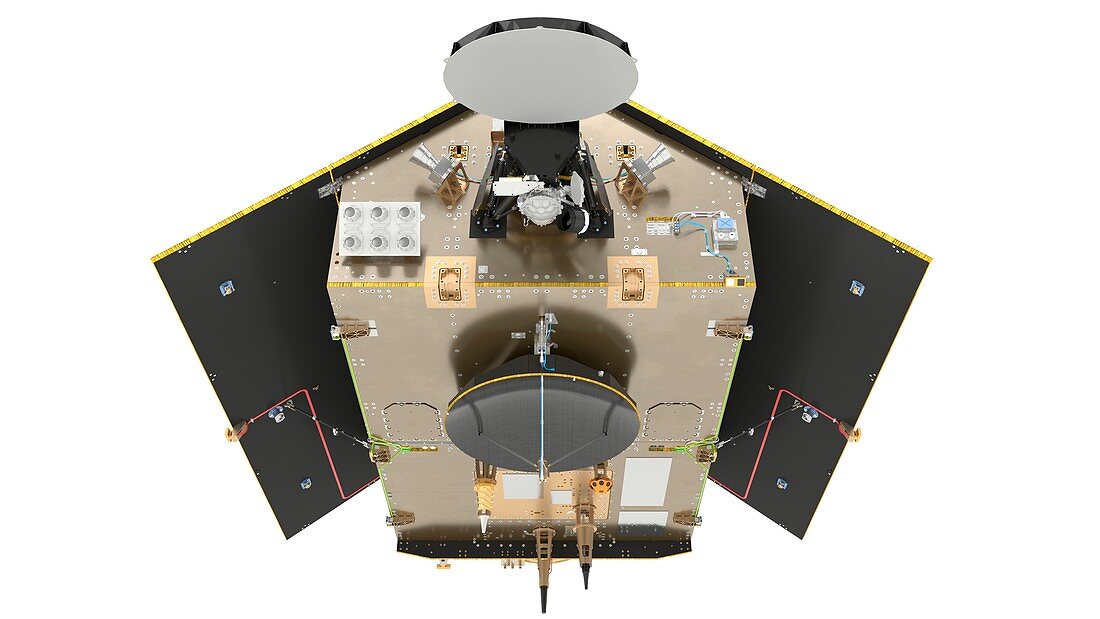
| Sentinel 6 satellite. Computer illustration of the ESA's (European Space Agency's) Sentinel 6 Michael Freilich satellite. The Sentinel 6 Michael Freilich (Sentinel 6A) program consists of 2 identical satellites that will measure sea surface levels and sea ice thickness. Each satellite carries a radar altimeter to provide high-precision and timely observations of the topography of the global ocean in an effort to better understand and monitor climate change. Sentinel 6A will be launched in late 2020, with the second satellite scheduled for launch in 2026. | |
| Lizenzart: | Lizenzpflichtig |
| Credit: | Science Photo Library / Corvaja, S. / ESA |
| Bildgröße: | 3840 px × 2160 px |
| Modell-Rechte: | nicht erforderlich |
| Eigentums-Rechte: | nicht erforderlich |
| Restrictions: |
|
Preise für dieses Bild ab 15 €
Universitäten & Organisationen
(Informationsmaterial Digital, Informationsmaterial Print, Lehrmaterial Digital etc.)
ab 15 €
Redaktionell
(Bücher, Bücher: Sach- und Fachliteratur, Digitale Medien (redaktionell) etc.)
ab 30 €
Werbung
(Anzeigen, Aussenwerbung, Digitale Medien, Fernsehwerbung, Karten, Werbemittel, Zeitschriften etc.)
ab 55 €
Handelsprodukte
(bedruckte Textilie, Kalender, Postkarte, Grußkarte, Verpackung etc.)
ab 75 €
Pauschalpreise
Rechtepakete für die unbeschränkte Bildnutzung in Print oder Online
ab 495 €
Keywords
- 21. Jahrhundert,
- ausgeschnitten,
- Ausrüstung,
- Ausschnitte,
- esa,
- Europa,
- europäisch,
- Europäische Weltraumbehörde,
- Forschung,
- geografisch,
- Geographie,
- Gerät,
- Globale Erwärmung,
- Illustration,
- Klimatologie,
- klimatologisch,
- Klimawandel,
- Kunstwerk,
- Luftfahrt,
- Maschine,
- Meereskunde,
- Niemand,
- Raumfahrzeug,
- Raumschiff,
- Satellit,
- Technologie,
- technologisch,
- topografisch,
- Topographie,
- topographisch,
- Überwachung,
- Umwelt,
- Umweltwissenschaften,
- weißer Hintergrund,
- Wetter