Global warming record,1970-1974
Bildnummer 12894599
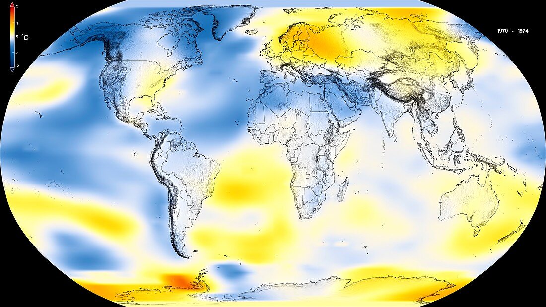
| Global warming record. Global map of surface temperature anomalies for the period 1970 to 1974. This is part of a sequence showing the trend of global warming from 1880 to 2018. Recent years have seen the warmest years since modern records began in 1880. This map shows where Earth's surface was warmer or cooler in the daytime than the average temperatures. Red is warmer than average,white is normal,and blue is cooler than average. The maps use the Robinson projection and the NASA Goddard Institute for Space Studies (GISS) Surface Temperature Analysis dataset (GISTEMP). For the full sequence of 12 images,see images C046/8745 to C046/8756. | |
| Lizenzart: | Lizenzpflichtig |
| Credit: | Science Photo Library / NASA's Scientific Visualization Studio / NASA |
| Bildgröße: | 5760 px × 3240 px |
| Modell-Rechte: | nicht erforderlich |
| Eigentums-Rechte: | nicht erforderlich |
| Restrictions: | - |
Preise für dieses Bild ab 15 €
Universitäten & Organisationen
(Informationsmaterial Digital, Informationsmaterial Print, Lehrmaterial Digital etc.)
ab 15 €
Redaktionell
(Bücher, Bücher: Sach- und Fachliteratur, Digitale Medien (redaktionell) etc.)
ab 30 €
Werbung
(Anzeigen, Aussenwerbung, Digitale Medien, Fernsehwerbung, Karten, Werbemittel, Zeitschriften etc.)
ab 55 €
Handelsprodukte
(bedruckte Textilie, Kalender, Postkarte, Grußkarte, Verpackung etc.)
ab 75 €
Pauschalpreise
Rechtepakete für die unbeschränkte Bildnutzung in Print oder Online
ab 495 €
Keywords
- 1900er Jahre,
- 20. Jahrhundert,
- Erdbeobachtung,
- Erde,
- geografisch,
- Geographie,
- Geschichte,
- Globale Erwärmung,
- historisch,
- Klimatologie,
- klimatologisch,
- Klimawandel,
- Kühler,
- Meteorologie,
- meteorologisch,
- NASA,
- Niemand,
- Planet,
- Reihenfolge,
- Robinson-Projektion,
- schwarzer Hintergrund,
- Serie,
- Welt,
- Wetter