Wildfires, California, USA, November 2018
Bildnummer 12582435
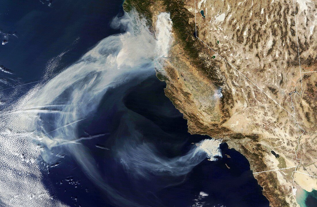
| Satellite image of smoke plumes from wildfires burning in California, USA, on 9th November 2018. At top in Northern California is the Camp Fire, in Southern California are the Hill and Woolsey Fires. All three fires started on the 8th November. Camp Fire is the most destructive wildfire in California history. As of November 11th it has burned more than 109, 000 acres of land and killed 29 people. Two people were also killed by the Woolsey Fire. Image obtained by the MODIS (Moderate Resolution Imaging Spectrometer) instrument on NASA's Terra satellite. | |
| Lizenzart: | Lizenzpflichtig |
| Credit: | Science Photo Library / NASA |
| Bildgröße: | 6538 px × 4275 px |
| Modell-Rechte: | nicht erforderlich |
| Eigentums-Rechte: | nicht erforderlich |
| Restrictions: | - |
Preise für dieses Bild ab 15 €
Universitäten & Organisationen
(Informationsmaterial Digital, Informationsmaterial Print, Lehrmaterial Digital etc.)
ab 15 €
Redaktionell
(Bücher, Bücher: Sach- und Fachliteratur, Digitale Medien (redaktionell) etc.)
ab 30 €
Werbung
(Anzeigen, Aussenwerbung, Digitale Medien, Fernsehwerbung, Karten, Werbemittel, Zeitschriften etc.)
ab 55 €
Handelsprodukte
(bedruckte Textilie, Kalender, Postkarte, Grußkarte, Verpackung etc.)
ab 75 €
Pauschalpreise
Rechtepakete für die unbeschränkte Bildnutzung in Print oder Online
ab 495 €