Arctic and North America, satellite image
Bildnummer 12393773
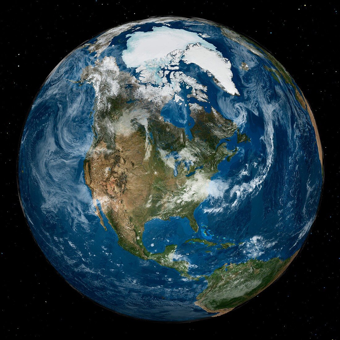
| Arctic and North America. Satellite image of the Earth with the full Arctic region visible. The sea ice is at its minimum annual extent in the northern hemisphere. Sea ice data is from the AMSR-E (Advanced Microwave Scanning Radiometer-EOS) instrument on the Aqua satellite. The land and cloud data is from the MODIS coverage by the Terra and Aqua satellites. The star field is from the Hipparcos satellite. This image was obtained on 21 September 2005, and released to mark the International Polar Year. | |
| Lizenzart: | Lizenzpflichtig |
| Credit: | Science Photo Library / NASA's Goddard Space Flight Center |
| Bildgröße: | 5310 px × 5310 px |
| Modell-Rechte: | nicht erforderlich |
| Eigentums-Rechte: | nicht erforderlich |
| Restrictions: | - |
Preise für dieses Bild ab 15 €
Universitäten & Organisationen
(Informationsmaterial Digital, Informationsmaterial Print, Lehrmaterial Digital etc.)
ab 15 €
Redaktionell
(Bücher, Bücher: Sach- und Fachliteratur, Digitale Medien (redaktionell) etc.)
ab 30 €
Werbung
(Anzeigen, Aussenwerbung, Digitale Medien, Fernsehwerbung, Karten, Werbemittel, Zeitschriften etc.)
ab 55 €
Handelsprodukte
(bedruckte Textilie, Kalender, Postkarte, Grußkarte, Verpackung etc.)
ab 75 €
Pauschalpreise
Rechtepakete für die unbeschränkte Bildnutzung in Print oder Online
ab 495 €
Keywords
- 1,
- 21. Jahrhundert,
- AMSR-E,
- aqua,
- Arktis,
- ausgeschnitten,
- Ausschnitte,
- Ball,
- Eis,
- Erdbeobachtung,
- Erde,
- geografisch,
- Geographie,
- Globus,
- Kugel,
- kugelförmig,
- Land,
- Meer,
- Meereis,
- modis,
- Niemand,
- Nordamerika,
- nordamerikanisch,
- nördliche Hemisphäre,
- Ozean,
- Planet,
- planetarisch,
- polar,
- Raum,
- Satellit,
- Satellitenbild,
- schwarzer Hintergrund,
- Terra,
- Weltall,
- Wolken