Edge of Pine Island Glacier, Antarctica, October 2014
Bildnummer 12325300
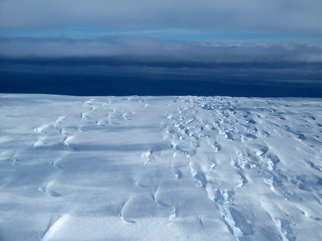
| Edge of Pine Island Glacier, Antarctica, aerial photograph. Calving front edge of the Pine Island Glacier in October 2014. This is where ice breaks free to form icebergs. This flight was part of an Operation IceBridge mission in October 2014. Pine Island Glacier is a type known as an ice stream, draining ice from the West Antarctic Ice Sheet into the ocean. If the glaciers in Antarctica disintegrate and melt, global sea levels would rise. Operation IceBridge is a NASA project that monitors polar ice cover using aircraft instead of satellites. It was introduced in 2009 as a replacement for the malfunctioning ICESat satellite.Photographed on 29 October 2014. | |
| Lizenzart: | Lizenzpflichtig |
| Credit: | Science Photo Library / Jim Yungel, NASA |
| Bildgröße: | 3411 px × 2558 px |
| Modell-Rechte: | nicht erforderlich |
| Eigentums-Rechte: | nicht erforderlich |
| Restrictions: | - |
Preise für dieses Bild ab 15 €
Universitäten & Organisationen
(Informationsmaterial Digital, Informationsmaterial Print, Lehrmaterial Digital etc.)
ab 15 €
Redaktionell
(Bücher, Bücher: Sach- und Fachliteratur, Digitale Medien (redaktionell) etc.)
ab 30 €
Werbung
(Anzeigen, Aussenwerbung, Digitale Medien, Fernsehwerbung, Karten, Werbemittel, Zeitschriften etc.)
ab 55 €
Handelsprodukte
(bedruckte Textilie, Kalender, Postkarte, Grußkarte, Verpackung etc.)
ab 75 €
Pauschalpreise
Rechtepakete für die unbeschränkte Bildnutzung in Print oder Online
ab 495 €
Keywords
- 1,
- 2014,
- 21. Jahrhundert,
- Antarktis,
- Eis,
- eisig,
- eislandschaft,
- Gefroren,
- Geowissenschaften,
- Glaziologie,
- Gletscher,
- Globale Erwärmung,
- Himmel,
- Horizont,
- Kalt,
- Kante,
- Klimatologie,
- klimatologisch,
- Klimawandel,
- Küste,
- Luftaufnahme,
- Luftaufnahmen,
- Meer,
- Mission,
- NASA,
- Niemand,
- polar,
- Umweltwissenschaften,
- Vogelperspektive,
- Wasser