Iceberg with attached sea ice, Antarctica
Bildnummer 12325297
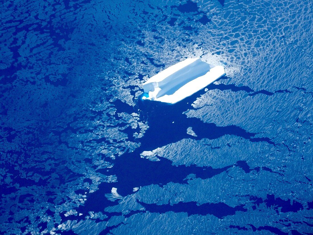
| Iceberg with attached sea ice, aerial photograph. The iceberg is floating near Adelaide Island, west of the Antarctic Peninsula. This flight was made as part of Operation IceBridge's 'English Coast' mission in November 2016. Operation IceBridge is a NASA project that monitors polar ice cover using aircraft instead of satellites. It was introduced in 2009 as a replacement for the malfunctioning ICESat satellite. Photographed on 17 November 2016. | |
| Lizenzart: | Lizenzpflichtig |
| Credit: | Science Photo Library / Maria-Jose Vinas, NASA |
| Bildgröße: | 4624 px × 3468 px |
| Modell-Rechte: | nicht erforderlich |
| Eigentums-Rechte: | nicht erforderlich |
| Restrictions: | - |
Preise für dieses Bild ab 15 €
Universitäten & Organisationen
(Informationsmaterial Digital, Informationsmaterial Print, Lehrmaterial Digital etc.)
ab 15 €
Redaktionell
(Bücher, Bücher: Sach- und Fachliteratur, Digitale Medien (redaktionell) etc.)
ab 30 €
Werbung
(Anzeigen, Aussenwerbung, Digitale Medien, Fernsehwerbung, Karten, Werbemittel, Zeitschriften etc.)
ab 55 €
Handelsprodukte
(bedruckte Textilie, Kalender, Postkarte, Grußkarte, Verpackung etc.)
ab 75 €
Pauschalpreise
Rechtepakete für die unbeschränkte Bildnutzung in Print oder Online
ab 495 €
Keywords
- 1,
- 2016,
- 21. Jahrhundert,
- Antarktis,
- Antarktische Halbinsel,
- Blau,
- Eis,
- Eisberg,
- eisig,
- Gefroren,
- Geowissenschaften,
- Glaziologie,
- Globale Erwärmung,
- Kalt,
- Klimatologie,
- klimatologisch,
- Klimawandel,
- Luftaufnahme,
- Luftaufnahmen,
- Meer,
- Meereis,
- Mission,
- NASA,
- Niemand,
- Ozean,
- polar,
- Umweltwissenschaften,
- Vogelperspektive,
- Wasser