Cyclone Debbie off Australian coast
Bildnummer 12325239
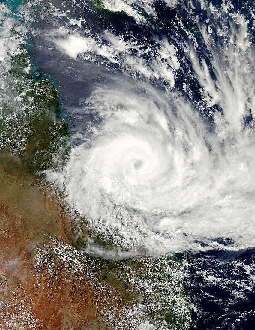
| Satellite image of tropical cyclone Debbie off the northeast coast of Australia. The cyclone, which has a 100 kilometre core, is due to make landfall in Queensland on the morning (local time) of Tuesday 28 March. At the time this image was taken the cyclone was a category 4 storm, with winds up to 251 kilometres per hour, but could intensify before landfall. Around 25, 000 residents have been evacuated from low-lying areas that are at risk of flooding as the storm is likely to coincide with a high tide. Image captured at 03.50 UTC on 27th March 2017, by the Moderate Resolution Imaging Spectroradiometer (MODIS) on NASA's Aqua satellite. | |
| Lizenzart: | Lizenzpflichtig |
| Credit: | Science Photo Library / NASA |
| Bildgröße: | 5211 px × 6744 px |
| Modell-Rechte: | nicht erforderlich |
| Eigentums-Rechte: | nicht erforderlich |
| Restrictions: | - |
Preise für dieses Bild ab 15 €
Universitäten & Organisationen
(Informationsmaterial Digital, Informationsmaterial Print, Lehrmaterial Digital etc.)
ab 15 €
Redaktionell
(Bücher, Bücher: Sach- und Fachliteratur, Digitale Medien (redaktionell) etc.)
ab 30 €
Werbung
(Anzeigen, Aussenwerbung, Digitale Medien, Fernsehwerbung, Karten, Werbemittel, Zeitschriften etc.)
ab 55 €
Handelsprodukte
(bedruckte Textilie, Kalender, Postkarte, Grußkarte, Verpackung etc.)
ab 75 €
Pauschalpreise
Rechtepakete für die unbeschränkte Bildnutzung in Print oder Online
ab 495 €