Hurricane Dean,20 August 2007
Bildnummer 11751735
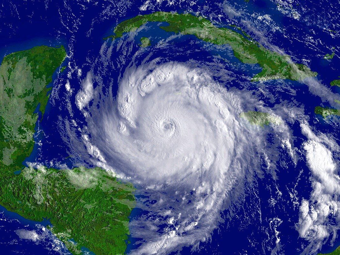
| Hurricane Dean,satellite image. North is at top. Image obtained at 04:55 local time on 20 August 2007 as the hurricane passed through the western Caribbean,moving from right to left. The island of Cuba is at upper right,and Mexico's Yucatan peninsula is at left. After the eye of the hurricane passed south of Jamaica on 19 August,it strengthened to become a category 5 hurricane with wind speeds of over 250 kilometres per hour,and a diameter of hundreds of kilometres. Hurricane Dean made landfall early in the morning of 21 August,coming ashore on the Yucatan peninsula. It was the first Atlantic hurricane to hit land as a category 5 since 1992. Image from NOAA's Geostationary Operational Environmental Satellite (GOES-12) | |
| Lizenzart: | Lizenzfrei |
| Credit: | Science Photo Library / NOAA |
| Modell-Rechte: | nicht erforderlich |
| Eigentums-Rechte: | nicht erforderlich |
| Restrictions: |
|
Preise für dieses Bild ab 29 €
Für digitale Nutzung (72 dpi)
ab 29 €
Für Druckauflösung (300 dpi)
ab 300 €