South America,night-day satellite image
Bildnummer 11751720
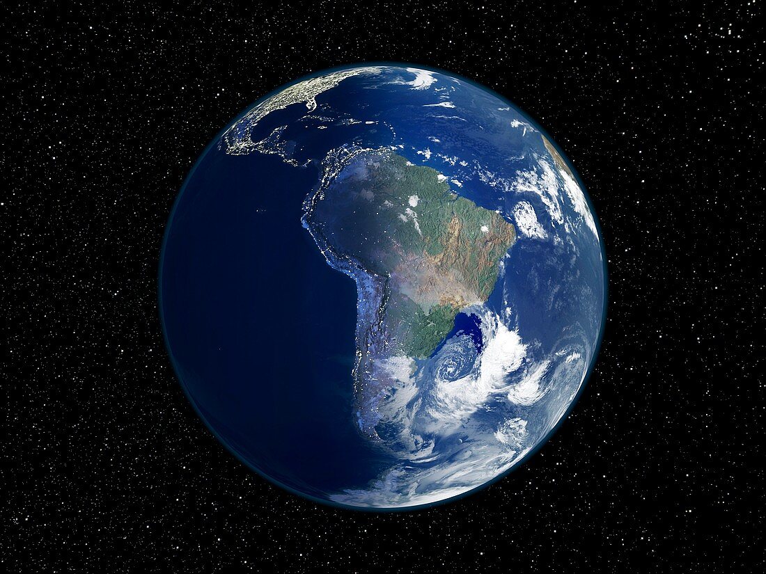
| South America,night-day satellite image. This composite image of the Earth is set against a background of stars,and is centred on South America. North is at top. The left-hand half of the globe is at night,and city lights (yellow) show areas of dense population. The right-hand half of the globe is lit by sunlight and shows clouds (white),seas and oceans (blue),and land cover: vegetation (green) and arid areas (brown). This day-night line is the dawn terminator. This image,from 2001,combines data from a variety of satellite sensors (AVHRR,SeaWiFS,MODIS) for the sunlit areas. Night-time data is from the Defense Meteorological Satellite Program (DMSP). For the separate images,see E074/086 and E050/684 | |
| Lizenzart: | Lizenzfrei |
| Credit: | Science Photo Library / NOAA / NASA |
| Modell-Rechte: | nicht erforderlich |
| Eigentums-Rechte: | nicht erforderlich |
| Restrictions: | - |
Preise für dieses Bild ab 29 €
Für digitale Nutzung (72 dpi)
ab 29 €
Für Druckauflösung (300 dpi)
ab 300 €
Keywords
- 21. Jahrhundert,
- AVHRR,
- bewohnt,
- Bild,
- Bilder,
- Dämmerung,
- Dichte,
- Distribution,
- DMSP,
- Energie,
- Erdbeobachtung,
- Erde,
- Erdkunde,
- Foto,
- Fotos,
- geografisch,
- Geographie,
- Globus,
- Hintergrund,
- Kontinent,
- Kontinente,
- künstlich,
- Land,
- Leistung,
- Licht,
- Lichter,
- Meer,
- Menschliche Bevölkerung,
- menschliche Geografie,
- Meteorologie,
- meteorologisch,
- modis,
- Nacht,
- Nachtzeit,
- Ozean,
- Planet,
- planetarisch,
- Raum,
- Satellit,
- Satellitenbild,
- Stadt,
- Städte,
- Stadtgeographie,
- städtisch,
- Sterne,
- Südamerika,
- Südamerikanisch,
- Tag,
- Tageszeit,
- Tagsüber,
- Technologie,
- technologisch,
- Umwelt,
- Unbewohnt,
- Wasser,
- Welt,
- Weltall,
- Wetter,
- Wissenschaften,
- Wolke,
- Wolken,
- Wolkendecke,
- Wolkig,
- Zusammengesetzt