New Orleans
Bildnummer 11748771
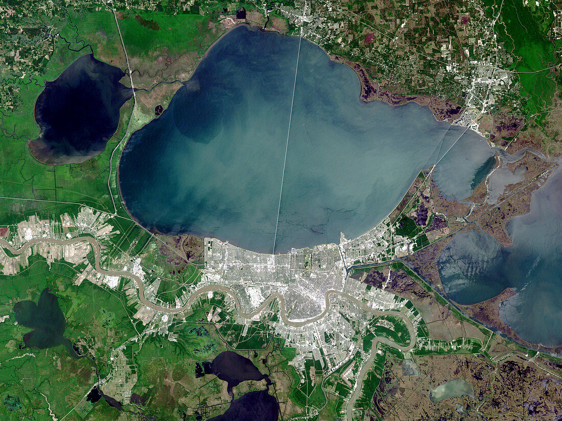
| New Orleans. True-colour satellite image of the city of New Orleans (lower centre),Louisiana,USA. North is at top. Vegetation is green,water is blue and urban areas are white/grey. The city is bordered by Lake Pontchartrain (upper centre) to the North. The Mississippi River (brown) flows through the city from far left to bottom centre. The city is built upon the delta formed by river sediments carried into the Gulf of Mexico. As the supply of sediments is reduced by dams,the delta is slowly being reclaimed by the sea. The Lake Pontchartrain Causeway heads north from the city over the lake. Image taken on 26 April 2000 by Landsat 7's Enhanced Thematic Mapper Plus (ETM+) | |
| Lizenzart: | Lizenzpflichtig |
| Credit: | Science Photo Library / NASA |
| Bildgröße: | 3286 px × 2465 px |
| Modell-Rechte: | nicht erforderlich |
| Eigentums-Rechte: | nicht erforderlich |
| Restrictions: | - |
Preise für dieses Bild ab 15 €
Universitäten & Organisationen
(Informationsmaterial Digital, Informationsmaterial Print, Lehrmaterial Digital etc.)
ab 15 €
Redaktionell
(Bücher, Bücher: Sach- und Fachliteratur, Digitale Medien (redaktionell) etc.)
ab 30 €
Werbung
(Anzeigen, Aussenwerbung, Digitale Medien, Fernsehwerbung, Karten, Werbemittel, Zeitschriften etc.)
ab 55 €
Handelsprodukte
(bedruckte Textilie, Kalender, Postkarte, Grußkarte, Verpackung etc.)
ab 75 €
Pauschalpreise
Rechtepakete für die unbeschränkte Bildnutzung in Print oder Online
ab 495 €
Keywords
- 2000,
- Amerika,
- Amerikanisch,
- Bilderwelt,
- Delta,
- etm,
- Fluss,
- Flüsse,
- Gebäude,
- Land,
- Landsat 7,
- Louisiana,
- New Orleans,
- Satellitenbild,
- See,
- Seen,
- Stadt,
- Städte,
- städtisch,
- Straße,
- uns,
- Urbanisierung,
- USA,
- Vegetation,
- Vereinigte Staaten,
- Wasser,
- Weltall