Disappearing Iraqi marshlands
Bildnummer 11745595
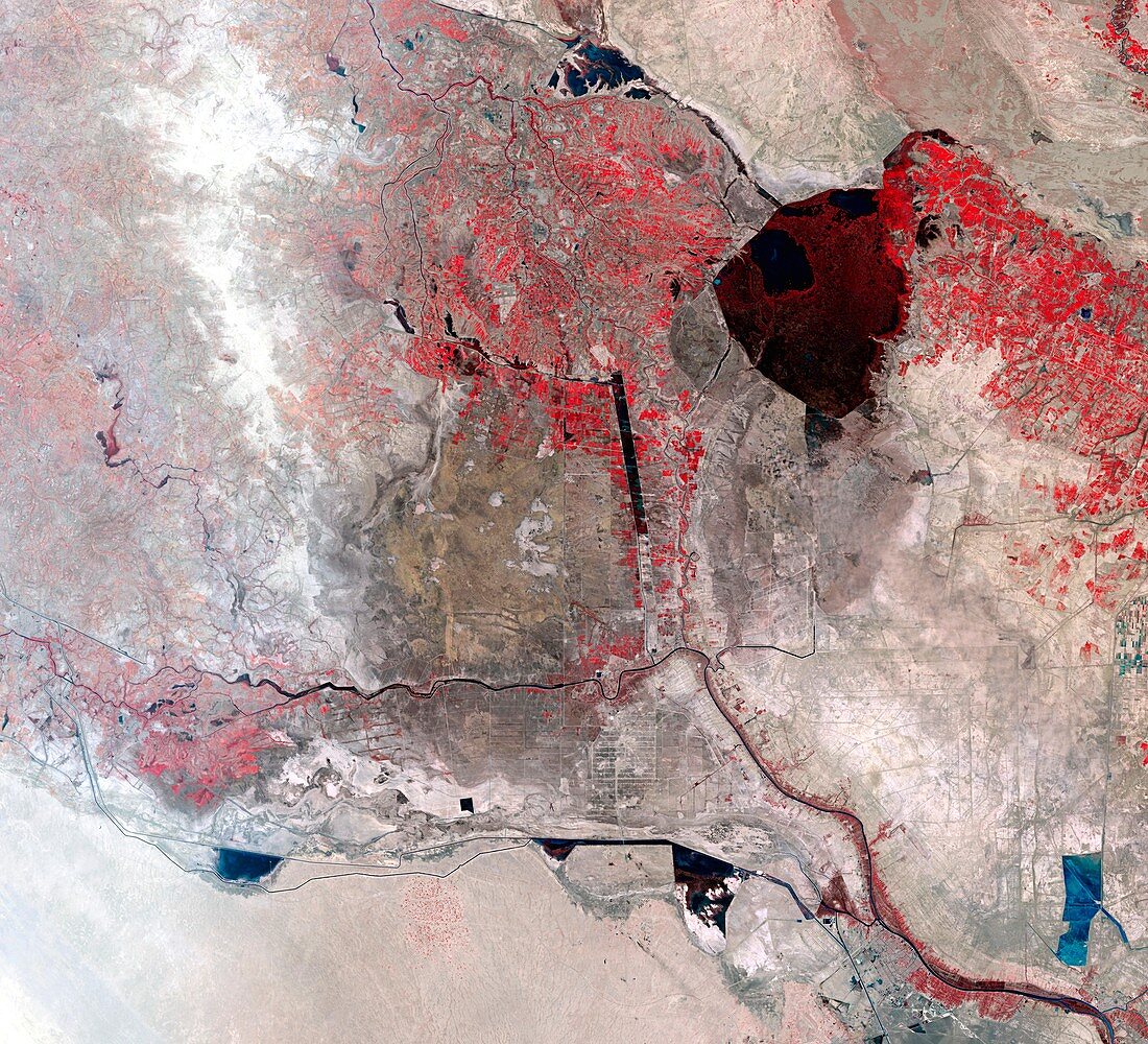
| Mesopotamia marsh drainage. Image 3 of 3. Coloured Landsat image of drained areas (grey) and marshes (dark red,upper right) around the Tigris (up centre) and Euphrates (along lower centre) rivers. This image was taken in 2000. The marshes straddle the border between Iraq and Iran (which lies east of the Tigris river,at far right). The marshes were systematically drained in the mid- to late 20th century. This was done to provide agricultural land,but also to destroy the habitat of the Shi'a Muslim Marsh Arabs,who were persecuted by the Iraqi ruling Ba'athist Party. For a sequence of images showing the marshes shrinking between 1973 and 2000,see E600/094-096 | |
| Lizenzart: | Lizenzpflichtig |
| Credit: | Science Photo Library / NASA |
| Bildgröße: | 5618 px × 5109 px |
| Modell-Rechte: | nicht erforderlich |
| Eigentums-Rechte: | nicht erforderlich |
| Restrictions: | - |
Preise für dieses Bild ab 15 €
Universitäten & Organisationen
(Informationsmaterial Digital, Informationsmaterial Print, Lehrmaterial Digital etc.)
ab 15 €
Redaktionell
(Bücher, Bücher: Sach- und Fachliteratur, Digitale Medien (redaktionell) etc.)
ab 30 €
Werbung
(Anzeigen, Aussenwerbung, Digitale Medien, Fernsehwerbung, Karten, Werbemittel, Zeitschriften etc.)
ab 55 €
Handelsprodukte
(bedruckte Textilie, Kalender, Postkarte, Grußkarte, Verpackung etc.)
ab 75 €
Pauschalpreise
Rechtepakete für die unbeschränkte Bildnutzung in Print oder Online
ab 495 €