Parana River Delta
Bildnummer 11745111
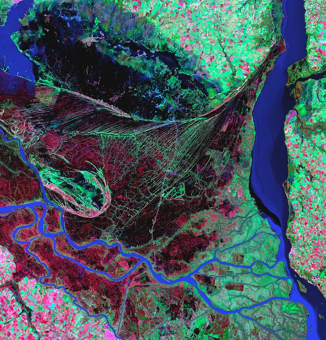
| Parana River Delta,satellite image. North is at top. Rivers are blue,marshland is black,forests and vegetation are green. The Parana River flows from top left down to centre left and then across to bottom right,spreading out to form the marshes of its delta. The River Uruguay flows vertically down far right,forming the border between Uruguay (far right) and Argentina (rest of image). Fields (green and pink rectangles) are also seen. The Parana River Delta is a large forested marshland,supporting numerous birds. Image taken on 26 May 2000,in visible and infrared wavelengths,by the Enhanced Thematic Mapper Plus (ETM+) sensor on NASA's Landsat 7 satellite | |
| Lizenzart: | Lizenzpflichtig |
| Credit: | Science Photo Library / NASA |
| Bildgröße: | 3384 px × 3529 px |
| Modell-Rechte: | nicht erforderlich |
| Eigentums-Rechte: | nicht erforderlich |
| Restrictions: | - |
Preise für dieses Bild ab 15 €
Universitäten & Organisationen
(Informationsmaterial Digital, Informationsmaterial Print, Lehrmaterial Digital etc.)
ab 15 €
Redaktionell
(Bücher, Bücher: Sach- und Fachliteratur, Digitale Medien (redaktionell) etc.)
ab 30 €
Werbung
(Anzeigen, Aussenwerbung, Digitale Medien, Fernsehwerbung, Karten, Werbemittel, Zeitschriften etc.)
ab 55 €
Handelsprodukte
(bedruckte Textilie, Kalender, Postkarte, Grußkarte, Verpackung etc.)
ab 75 €
Pauschalpreise
Rechtepakete für die unbeschränkte Bildnutzung in Print oder Online
ab 495 €
Keywords
- 2000,
- Amerikanisch,
- Argentinien,
- Argentinier,
- Bauernhof,
- Bauernhöfe,
- Blütezeit,
- Delta,
- Erde aus dem Weltraum,
- etm,
- Feld,
- Felder,
- Feuchtgebiet,
- Feuchtgebiete,
- Fluss,
- Flüsse,
- geografisch,
- Geographie,
- Hagedorn,
- infrarot,
- Landsat 7,
- Landwirtschaft,
- landwirtschaftlich,
- Mündung,
- Nuss,
- nusshaltig,
- optisch,
- Rand,
- Satellit,
- Südamerika,
- Sumpf,
- Umwelt,
- Uruguay