Chesapeake Bay
Bildnummer 11745103
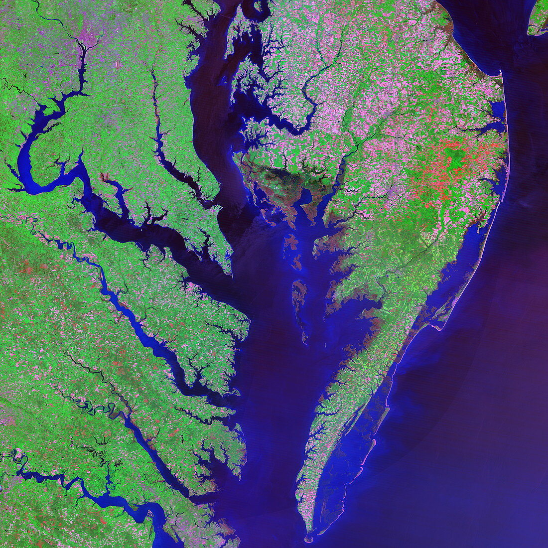
| Chesapeake Bay. Coloured optical and infrared,Landsat satellite image of Chesapeake Bay on the north-eastern coast of the USA. North is at top. Water is blue,vegetation is green and urban areas are purple. Fields and other cultivated areas form a patchwork of pink and green (upper right). Several rivers flow into the bay from the mainland to the left. The largest of these is the Potomac River,which flows down from the purple area at top left. This purple area is Washington D.C.,the capital city of the USA. Brown coastal areas (near centre),on the peninsula at right,are marshes that support many thousands of water birds | |
| Lizenzart: | Lizenzpflichtig |
| Credit: | Science Photo Library / MDA Information Systems |
| Bildgröße: | 4180 px × 4180 px |
| Modell-Rechte: | nicht erforderlich |
| Eigentums-Rechte: | nicht erforderlich |
| Restrictions: | - |
Preise für dieses Bild ab 15 €
Universitäten & Organisationen
(Informationsmaterial Digital, Informationsmaterial Print, Lehrmaterial Digital etc.)
ab 15 €
Redaktionell
(Bücher, Bücher: Sach- und Fachliteratur, Digitale Medien (redaktionell) etc.)
ab 30 €
Werbung
(Anzeigen, Aussenwerbung, Digitale Medien, Fernsehwerbung, Karten, Werbemittel, Zeitschriften etc.)
ab 55 €
Handelsprodukte
(bedruckte Textilie, Kalender, Postkarte, Grußkarte, Verpackung etc.)
ab 75 €
Pauschalpreise
Rechtepakete für die unbeschränkte Bildnutzung in Print oder Online
ab 495 €
Keywords
- Amerika,
- Amerikanisch,
- Atlantisch,
- Bodennutzung,
- Buchten,
- Chesapeake Bay,
- Delta,
- Erdkunde,
- farbig,
- Feld,
- Felder,
- Fluss,
- Flüsse,
- geografisch,
- Geographie,
- Hauptstadt,
- infrarot,
- ir,
- Küste,
- Küsten-,
- Landwirtschaft,
- Maryland,
- Mündung,
- optisch,
- Patchwork,
- Satellitenbild,
- Stadt,
- Städte,
- städtisch,
- Sumpf,
- uns,
- USA,
- Vegetation,
- Vereinigte Staaten,
- Virginia,
- Wasser,
- Weltall