Parana and Iguacu rivers
Bildnummer 11744890
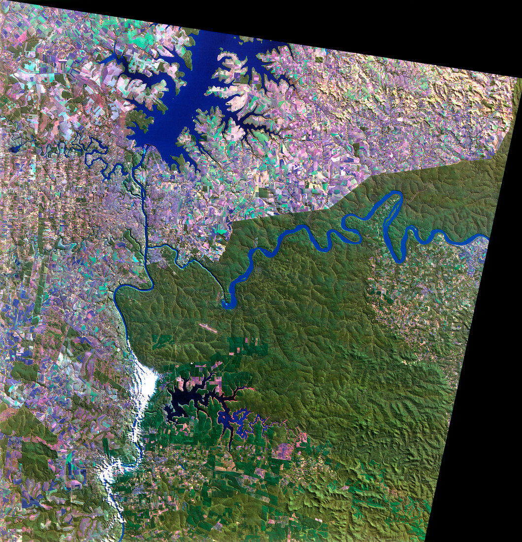
| Parana and Iguacu rivers,South America,satellite image. North is at top. Water is blue,vegetation is green,cultivated fields (rectangles) are pink and clouds are white. The Parana River (down left) forms a border with Paraguay (left). The river has formed a lake (top) behind the Itaipu Dam,one of the largest hydroelectric plants in the world. The broad Iguacu River (from right) divides Argentina (lower) from Brazil (upper),and plunges 82 metres over the Iguacu Falls into a narrower channel that enters the Parana River. This 105-kilometre-wide,visible & infrared image was taken on 28 June 1994 by the Thematic Mapper on the Landsat 5 satellite | |
| Lizenzart: | Lizenzpflichtig |
| Credit: | Science Photo Library / MDA Information Systems |
| Bildgröße: | 4326 px × 4488 px |
| Modell-Rechte: | nicht erforderlich |
| Eigentums-Rechte: | nicht erforderlich |
| Restrictions: | - |
Preise für dieses Bild ab 15 €
Universitäten & Organisationen
(Informationsmaterial Digital, Informationsmaterial Print, Lehrmaterial Digital etc.)
ab 15 €
Redaktionell
(Bücher, Bücher: Sach- und Fachliteratur, Digitale Medien (redaktionell) etc.)
ab 30 €
Werbung
(Anzeigen, Aussenwerbung, Digitale Medien, Fernsehwerbung, Karten, Werbemittel, Zeitschriften etc.)
ab 55 €
Handelsprodukte
(bedruckte Textilie, Kalender, Postkarte, Grußkarte, Verpackung etc.)
ab 75 €
Pauschalpreise
Rechtepakete für die unbeschränkte Bildnutzung in Print oder Online
ab 495 €
Keywords
- Amerikanisch,
- Anbau,
- Argentinien,
- Argentinier,
- Bauernhof,
- Bauernhöfe,
- bewaldet,
- Bodennutzung,
- Brasilianer,
- Brasilien,
- Damm,
- Dschungel,
- farbig,
- Feld,
- Felder,
- Fluss,
- Flüsse,
- geografisch,
- Geographie,
- infrarot,
- ir,
- Juni,
- kultiviert,
- Landwirtschaft,
- landwirtschaftlich,
- Nuss,
- nusshaltig,
- optisch,
- Paraguay,
- Pflanzen,
- Regenwald,
- Satellit,
- See,
- Sichtbar,
- Südamerika,
- Tm,
- Umwelt,
- Vegetation,
- Wald,
- Wälder,
- Wasser,
- Weltall