River Nile
Bildnummer 11744887
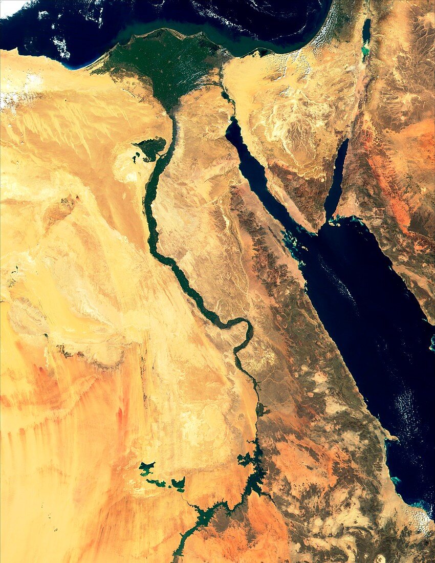
| River Nile,true-colour satellite image. North is at top. Water is blue,deserts are brown,clouds are white. The lower reaches of the River Nile flow through Egypt's deserts before reaching the Mediterranean coast,forming a delta (triangular,upper centre). Lake Nasser (lower centre) formed behind the Aswan Dam. The Red Sea (centre right) divides into two gulfs either side of the Sinai Peninsula. The Gulf of Suez (left) leads to the Suez Canal. The Gulf of Aqaba (right) points towards Israel,with Jordan and Saudi Arabia to its right. Image taken on 28 February 2000 by the Moderate Resolution Imaging Spectroradiometer (MODIS) aboard NASA's Terra satellite | |
| Lizenzart: | Lizenzpflichtig |
| Credit: | Science Photo Library / NASA |
| Bildgröße: | 3602 px × 4659 px |
| Modell-Rechte: | nicht erforderlich |
| Eigentums-Rechte: | nicht erforderlich |
| Restrictions: | - |
Preise für dieses Bild ab 15 €
Universitäten & Organisationen
(Informationsmaterial Digital, Informationsmaterial Print, Lehrmaterial Digital etc.)
ab 15 €
Redaktionell
(Bücher, Bücher: Sach- und Fachliteratur, Digitale Medien (redaktionell) etc.)
ab 30 €
Werbung
(Anzeigen, Aussenwerbung, Digitale Medien, Fernsehwerbung, Karten, Werbemittel, Zeitschriften etc.)
ab 55 €
Handelsprodukte
(bedruckte Textilie, Kalender, Postkarte, Grußkarte, Verpackung etc.)
ab 75 €
Pauschalpreise
Rechtepakete für die unbeschränkte Bildnutzung in Print oder Online
ab 495 €
Keywords
- 2000,
- Afrika,
- Afrikanisch,
- Ägypten,
- Ägyptisch,
- Bilderwelt,
- Delta,
- Februar,
- geografisch,
- Geographie,
- Land,
- Meer,
- Mittlerer Osten,
- modis,
- Ozean,
- rot,
- Satellitenbild,
- Sinai,
- Spektrometer,
- Spektroradiometer,
- Terra,
- trocken,
- Umwelt,
- Wasser,
- Weltall,
- Wolke,
- Wolken,
- Wolkig,
- Wüste