Grand Canyon
Bildnummer 11744794
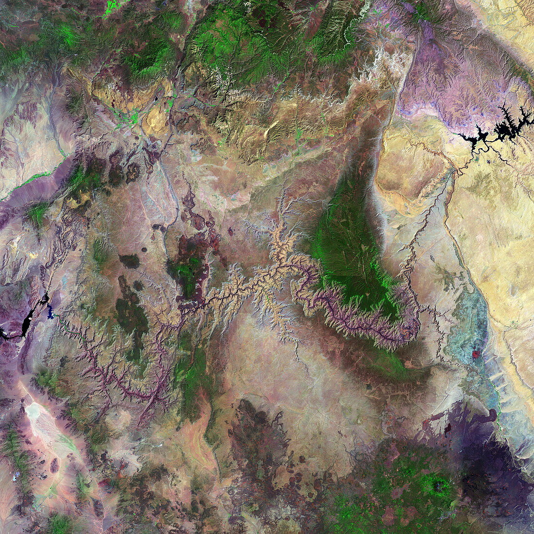
| Grand Canyon. Coloured optical and infrared,Landsat satellite image of the Grand Canyon,Arizona,USA. North is at top. Arid areas are brown and purple,forests are green and water is black. The Grand Canyon is a massive gorge that has been formed by the Colorado River eroding into the Earth. It is seen as a fissured line snaking from Lake Powell (top right) to Lake Mead (far left). The 6-million-year-old Grand Canyon system is around 446 kilometres long,29 kilometres wide and 1.5 kilometres deep. The contrasting rock colours (purple,blue and brown) in the image are due to the presence of coloured volcanic rocks | |
| Lizenzart: | Lizenzpflichtig |
| Credit: | Science Photo Library / MDA Information Systems |
| Bildgröße: | 4180 px × 4180 px |
| Modell-Rechte: | nicht erforderlich |
| Eigentums-Rechte: | nicht erforderlich |
| Restrictions: | - |
Preise für dieses Bild ab 15 €
Universitäten & Organisationen
(Informationsmaterial Digital, Informationsmaterial Print, Lehrmaterial Digital etc.)
ab 15 €
Redaktionell
(Bücher, Bücher: Sach- und Fachliteratur, Digitale Medien (redaktionell) etc.)
ab 30 €
Werbung
(Anzeigen, Aussenwerbung, Digitale Medien, Fernsehwerbung, Karten, Werbemittel, Zeitschriften etc.)
ab 55 €
Handelsprodukte
(bedruckte Textilie, Kalender, Postkarte, Grußkarte, Verpackung etc.)
ab 75 €
Pauschalpreise
Rechtepakete für die unbeschränkte Bildnutzung in Print oder Online
ab 495 €
Keywords
- Amerika,
- Amerikanisch,
- Arizona,
- Colorado,
- Erdkunde,
- farbig,
- Felsen,
- Fluss,
- Flüsse,
- geografisch,
- Geographie,
- Grand Canyon,
- infrarot,
- ir,
- Land,
- Met,
- optisch,
- Reservoir,
- Satellitenbild,
- trocken,
- uns,
- USA,
- Vegetation,
- Vereinigte Staaten,
- Vulkangestein,
- Wald,
- Weltall,
- Wüste