Chesapeake and Delaware Bays,USA
Bildnummer 11739918
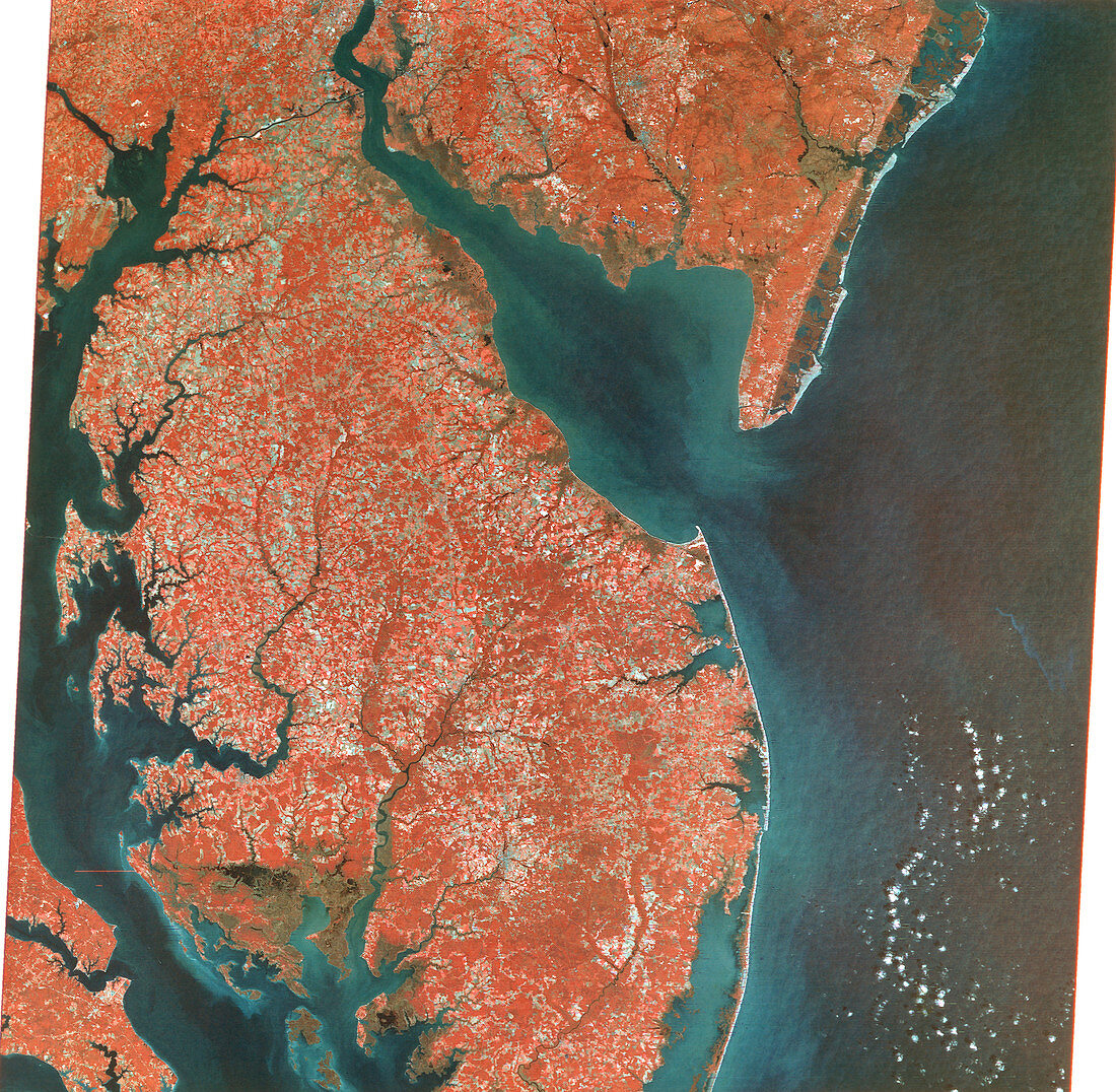
| Chesapeake and Delaware Bays,USA,combined visible and infrared satellite image. North is at top. Chesapeake (down left) and Delaware (upper centre) Bays are inlets of the Atlantic Ocean (blue),and are surrounded by the states of Virginia (bottom left),Delaware (centre),Maryland (centre left to bottom left) and New Jersey (upper right). Vegetation is red and clouds are white. Photographed by Landsat 1 on 10th October 1972 | |
| Lizenzart: | Lizenzpflichtig |
| Credit: | Science Photo Library / MDA Information Systems |
| Bildgröße: | 5013 px × 4902 px |
| Modell-Rechte: | nicht erforderlich |
| Eigentums-Rechte: | nicht erforderlich |
| Restrictions: | - |
Preise für dieses Bild ab 15 €
Universitäten & Organisationen
(Informationsmaterial Digital, Informationsmaterial Print, Lehrmaterial Digital etc.)
ab 15 €
Redaktionell
(Bücher, Bücher: Sach- und Fachliteratur, Digitale Medien (redaktionell) etc.)
ab 30 €
Werbung
(Anzeigen, Aussenwerbung, Digitale Medien, Fernsehwerbung, Karten, Werbemittel, Zeitschriften etc.)
ab 55 €
Handelsprodukte
(bedruckte Textilie, Kalender, Postkarte, Grußkarte, Verpackung etc.)
ab 75 €
Pauschalpreise
Rechtepakete für die unbeschränkte Bildnutzung in Print oder Online
ab 495 €