Preparing for GPS mapping of a glacier
Bildnummer 11739135
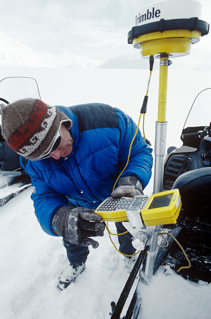
| MODEL RELEASED. GPS topographical glacier mapping. Glaciologist setting up a Global Positioning System (GPS) unit on a snowmobile,prior to mapping a glacier. This technique is called differential GPS (DGPS). DGPS is a way of improving the accuracy of GPS by using a signal from a fixed base station as well as the usual signals from orbiting satellites. It allows measurement of positional accuracy within a metre. Once set up,the glaciologist will drive the snowmobile over the entire glacier,mapping its extent and topography. Photographed on the Marmaglaciaren glacier in Swedish Lapland,in spring 2006 | |
| Lizenzart: | Lizenzpflichtig |
| Credit: | Science Photo Library / Hay Jones, David |
| Bildgröße: | 3411 px × 5152 px |
| Modell-Rechte: | vorhanden |
| Eigentums-Rechte: | nicht erforderlich |
| Restrictions: | - |
Preise für dieses Bild ab 15 €
Universitäten & Organisationen
(Informationsmaterial Digital, Informationsmaterial Print, Lehrmaterial Digital etc.)
ab 15 €
Redaktionell
(Bücher, Bücher: Sach- und Fachliteratur, Digitale Medien (redaktionell) etc.)
ab 30 €
Werbung
(Anzeigen, Aussenwerbung, Digitale Medien, Fernsehwerbung, Karten, Werbemittel, Zeitschriften etc.)
ab 55 €
Handelsprodukte
(bedruckte Textilie, Kalender, Postkarte, Grußkarte, Verpackung etc.)
ab 75 €
Pauschalpreise
Rechtepakete für die unbeschränkte Bildnutzung in Print oder Online
ab 495 €
Keywords
- 1,
- 3-d,
- 3D,
- Ausrüstung,
- Einrichtung,
- Eis,
- Erwachsene,
- Forscher,
- Forschung,
- Glaziologie,
- Globale Erwärmung,
- Kalt,
- kaukasisch,
- Klimaforscher,
- Klimatologie,
- klimatologisch,
- Klimawandel,
- Mann,
- Männlich,
- Mensch,
- Menschen,
- Person,
- Satellit,
- Schnee,
- Schneemobil,
- Schweden,
- Schwedisch,
- Tarfala,
- topografisch,
- Topographie,
- topographisch,
- Überprüfung,
- Umwelt,
- vorbereitend,
- Vorbereitung,
- weiß