Arctic ice minimum extent,2008
Bildnummer 11738899
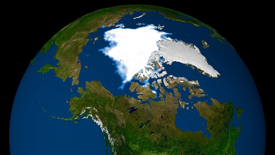
| Arctic ice minimum extent,2008. Satellite image showing the Arctic polar ice cap (upper centre) and Northwest Passage (centre),which connects the Pacific (left) and Atlantic (right) oceans through the Canadian Arctic Archipelago. This was the second lowest ice coverage after 2007's record minimum,where the sea ice had receded so much that it opened the Northwest Passage. Image produced using observations by the SSMI (Special Sensor Microwave Imager) instrument on the US Air Force's Defense Meteorological Satellite Program (DMSP) on 14th September 2008 | |
| Lizenzart: | Lizenzpflichtig |
| Credit: | Science Photo Library / SCIENTIFIC VISUALIZATION STUDIO / GSFC / NASA |
| Bildgröße: | 5602 px × 3151 px |
| Modell-Rechte: | nicht erforderlich |
| Eigentums-Rechte: | nicht erforderlich |
| Restrictions: | - |
Preise für dieses Bild ab 15 €
Universitäten & Organisationen
(Informationsmaterial Digital, Informationsmaterial Print, Lehrmaterial Digital etc.)
ab 15 €
Redaktionell
(Bücher, Bücher: Sach- und Fachliteratur, Digitale Medien (redaktionell) etc.)
ab 30 €
Werbung
(Anzeigen, Aussenwerbung, Digitale Medien, Fernsehwerbung, Karten, Werbemittel, Zeitschriften etc.)
ab 55 €
Handelsprodukte
(bedruckte Textilie, Kalender, Postkarte, Grußkarte, Verpackung etc.)
ab 75 €
Pauschalpreise
Rechtepakete für die unbeschränkte Bildnutzung in Print oder Online
ab 495 €
Keywords
- 21. Jahrhundert,
- Aleuten,
- alljährlich,
- Arktis,
- Arktischer Ozean,
- Atlantischer Ozean,
- Breit,
- DMSP,
- Durchgang,
- Erdbeobachtung,
- Geöffnet,
- geografisch,
- Geographie,
- Globale Erwärmung,
- Kanada,
- Klimatologie,
- klimatologisch,
- Klimawandel,
- Meer,
- Meereis,
- Nordamerika,
- nordamerikanisch,
- Nördlicher Polarkreis,
- Öffnen,
- Ozean,
- Passage,
- Pazifik,
- Provinz,
- Region,
- Rückzug,
- Russland,
- Satellit,
- Satellitenbild,
- Schmelzen,
- September,
- SSMI,
- Umwelt,
- US-Luftwaffe,
- Verschwinden,
- Weltall