Arctic ice minimum extent,2007
Bildnummer 11738847
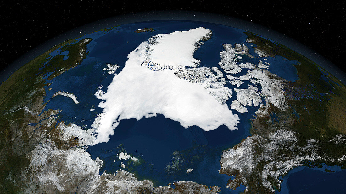
| Arctic ice minimum extent,2007. Satellite image showing the Arctic polar ice cap (centre),with Greenland (upper centre) and the Northwest Passage (centre right),a strip of sea connecting the Atlantic Ocean (top) to the Pacific Ocean (bottom right). The receding sea ice widened the Northwest Passage,making it fully open in August 2007. Declining sea ice is due to global warming,and the Arctic temperatures were at a record high in 2007,having risen by 1.7-2.2 degrees Celsius in the past century. The East Siberian Sea (lower centre) and the Barents Sea (upper left) are also seen. Photographed on 14th September 2007 by the Advanced Microwave Scanning Radiometer (AMSR-E) instrument aboard NASA's Aqua satellite | |
| Lizenzart: | Lizenzpflichtig |
| Credit: | Science Photo Library / SCIENTIFIC VISUALIZATION STUDIO / GSFC / NASA |
| Bildgröße: | 3840 px × 2160 px |
| Modell-Rechte: | nicht erforderlich |
| Eigentums-Rechte: | nicht erforderlich |
| Restrictions: | - |
Preise für dieses Bild ab 15 €
Universitäten & Organisationen
(Informationsmaterial Digital, Informationsmaterial Print, Lehrmaterial Digital etc.)
ab 15 €
Redaktionell
(Bücher, Bücher: Sach- und Fachliteratur, Digitale Medien (redaktionell) etc.)
ab 30 €
Werbung
(Anzeigen, Aussenwerbung, Digitale Medien, Fernsehwerbung, Karten, Werbemittel, Zeitschriften etc.)
ab 55 €
Handelsprodukte
(bedruckte Textilie, Kalender, Postkarte, Grußkarte, Verpackung etc.)
ab 75 €
Pauschalpreise
Rechtepakete für die unbeschränkte Bildnutzung in Print oder Online
ab 495 €
Keywords
- 21. Jahrhundert,
- AMSR-E,
- Arktis,
- Arktischer Ozean,
- Atlantischer Ozean,
- Durchgang,
- Erdbeobachtung,
- geografisch,
- Geographie,
- Globale Erwärmung,
- Instrument,
- Kanal,
- Klar,
- Klimatologie,
- klimatologisch,
- Klimawandel,
- Küste,
- Küstenlinie,
- Meer,
- Meereis,
- NASA,
- Nördlicher Polarkreis,
- Öffnen,
- Ozean,
- Passage,
- Pazifik,
- Provinz,
- Region,
- Route,
- Rückzug,
- Satellit,
- Satellitenbild,
- Schmelzen,
- Umwelt,
- Verschwinden,
- Weltall