Flood risk in London,aerial view
Bildnummer 11738449
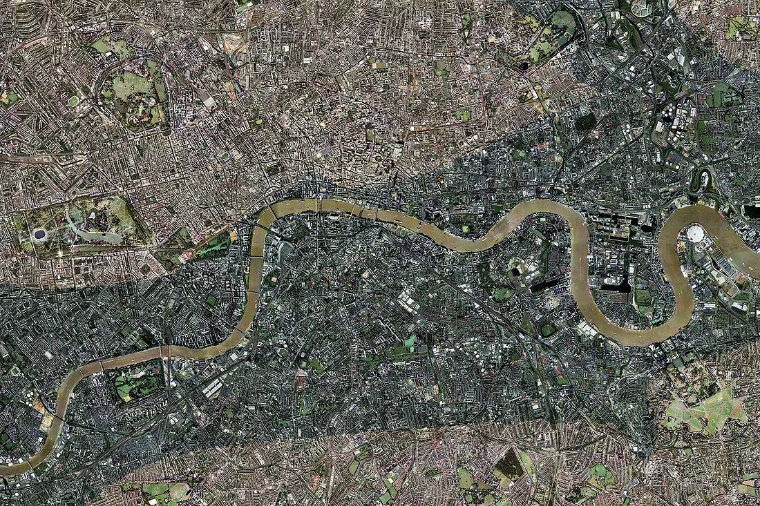
| Flood risk in London. Aerial photograph of central London illustrating the areas at risk of flooding due to a rise in sea-level. North is at top. Global sea-level is predicted to rise by up to a metre over the next hundred years. Such a rise would cause much of central London to be inundated. In this image,the areas most at risk are shaded. This land is at or below the 10 metre contour line. Important areas at risk include the Houses of Parliament and Whitehall,which are situated on the north bank of the River Thames (brown),just below the bend at centre left. Stratford (shaded area at upper right) is situated near the banks of the River Lea,a tributary of the Thames. It is is where the Olympic Village of the 2012 Olympics is located | |
| Lizenzart: | Lizenzpflichtig |
| Credit: | Science Photo Library / Getmapping Plc |
| Bildgröße: | 5254 px × 3502 px |
| Modell-Rechte: | nicht erforderlich |
| Eigentums-Rechte: | nicht erforderlich |
| Restrictions: | - |
Preise für dieses Bild ab 15 €
Universitäten & Organisationen
(Informationsmaterial Digital, Informationsmaterial Print, Lehrmaterial Digital etc.)
ab 15 €
Redaktionell
(Bücher, Bücher: Sach- und Fachliteratur, Digitale Medien (redaktionell) etc.)
ab 30 €
Werbung
(Anzeigen, Aussenwerbung, Digitale Medien, Fernsehwerbung, Karten, Werbemittel, Zeitschriften etc.)
ab 55 €
Handelsprodukte
(bedruckte Textilie, Kalender, Postkarte, Grußkarte, Verpackung etc.)
ab 75 €
Pauschalpreise
Rechtepakete für die unbeschränkte Bildnutzung in Print oder Online
ab 495 €
Keywords
- britisch,
- Ebenen,
- England,
- Englisch,
- Fluss,
- Flut,
- Futuristisch,
- geografisch,
- Geographie,
- Globale Erwärmung,
- Großbritannien,
- Hauptstadt,
- Klima,
- Klimatologie,
- klimatologisch,
- Klimawandel,
- London,
- Luftaufnahmen,
- Meteorologie,
- meteorologisch,
- projiziert,
- Risiko,
- Stadt,
- Steigend,
- Überschwemmung,
- Vereinigtes Königreich,
- Verwüstung,
- Vogelperspektive,
- Weltall,
- Wetter,
- zentral,
- Zukunft