Monsoon floods
Bildnummer 11738417
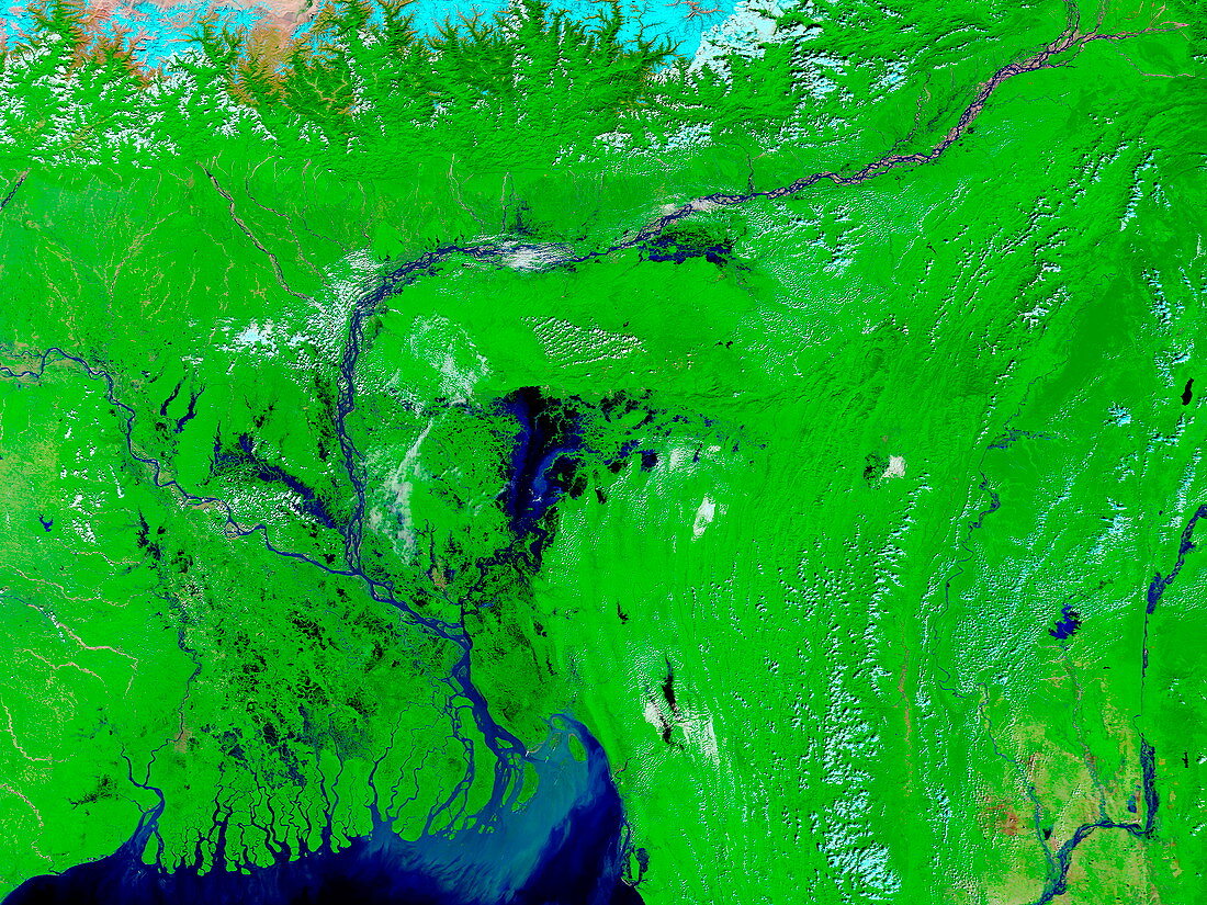
| Monsoon floods. False-colour satellite image of floods caused by monsoon rains in Bangladesh (centre left) and India (far left,centre right). Rivers have burst their banks and the terrain surrounding the Ganges River (centre left) and Brahmaputra River (upper right) is waterlogged. Standing water is visible,particularly in Dhaka (centre),the capital city of Bangladesh. Although flooding during the monsoon season is normal,many parts of India,Bangladesh and Nepal are being flooded more severely than usual. Image taken on 20 October 2004 at 04:40 GMT by the Moderate Resolution Imaging Spectroradiometer (MODIS) aboard NASA's Terra satellite | |
| Lizenzart: | Lizenzpflichtig |
| Credit: | Science Photo Library / NASA |
| Bildgröße: | 4000 px × 3000 px |
| Modell-Rechte: | nicht erforderlich |
| Eigentums-Rechte: | nicht erforderlich |
| Restrictions: | - |
Preise für dieses Bild ab 15 €
Universitäten & Organisationen
(Informationsmaterial Digital, Informationsmaterial Print, Lehrmaterial Digital etc.)
ab 15 €
Redaktionell
(Bücher, Bücher: Sach- und Fachliteratur, Digitale Medien (redaktionell) etc.)
ab 30 €
Werbung
(Anzeigen, Aussenwerbung, Digitale Medien, Fernsehwerbung, Karten, Werbemittel, Zeitschriften etc.)
ab 55 €
Handelsprodukte
(bedruckte Textilie, Kalender, Postkarte, Grußkarte, Verpackung etc.)
ab 75 €
Pauschalpreise
Rechtepakete für die unbeschränkte Bildnutzung in Print oder Online
ab 495 €