Hurricane Dean,22nd August 2007
Bildnummer 11738091
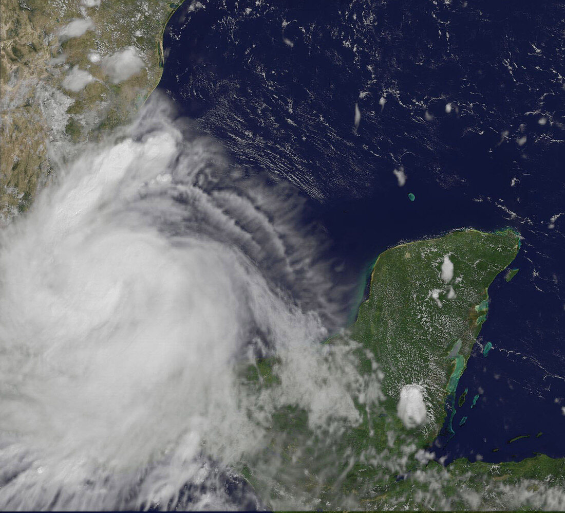
| Hurricane Dean,satellite image. North is at top. Image obtained at 13:10 local time on 22nd August 2007 as it moves inland over Mexico after making its second landfall. At this point Dean had weakened to a Category 1 hurricane,with sustained winds of 135 kilometres per hour. Dean had made landfall on the morning of the 22nd August near the town of Tecolutla as a Category 2 hurricane. Dean made its first landfall on 21st August on Mexico's Yucatan peninsula (lower right). At the time it was a Category 5,and the first Atlantic hurricane to make landfall as a Category 5 since 1992. As it moves inland Dean will bring heavy rain with the risk of widespread flooding and mudslides. Image obtained by NOAA's Geostationary Operational Environmental Satellite (GOES-12) | |
| Lizenzart: | Lizenzpflichtig |
| Credit: | Science Photo Library / Goes Project / NASA / NOAA |
| Bildgröße: | 1422 px × 1290 px |
| Modell-Rechte: | nicht erforderlich |
| Eigentums-Rechte: | nicht erforderlich |
| Restrictions: | - |
Preise für dieses Bild ab 15 €
Universitäten & Organisationen
(Informationsmaterial Digital, Informationsmaterial Print, Lehrmaterial Digital etc.)
ab 15 €
Redaktionell
(Bücher, Bücher: Sach- und Fachliteratur, Digitale Medien (redaktionell) etc.)
ab 30 €
Werbung
(Anzeigen, Aussenwerbung, Digitale Medien, Fernsehwerbung, Karten, Werbemittel, Zeitschriften etc.)
ab 55 €
Handelsprodukte
(bedruckte Textilie, Kalender, Postkarte, Grußkarte, Verpackung etc.)
ab 75 €
Pauschalpreise
Rechtepakete für die unbeschränkte Bildnutzung in Print oder Online
ab 495 €