Hurricane Dean's landfall,21 August 2007
Bildnummer 11738090
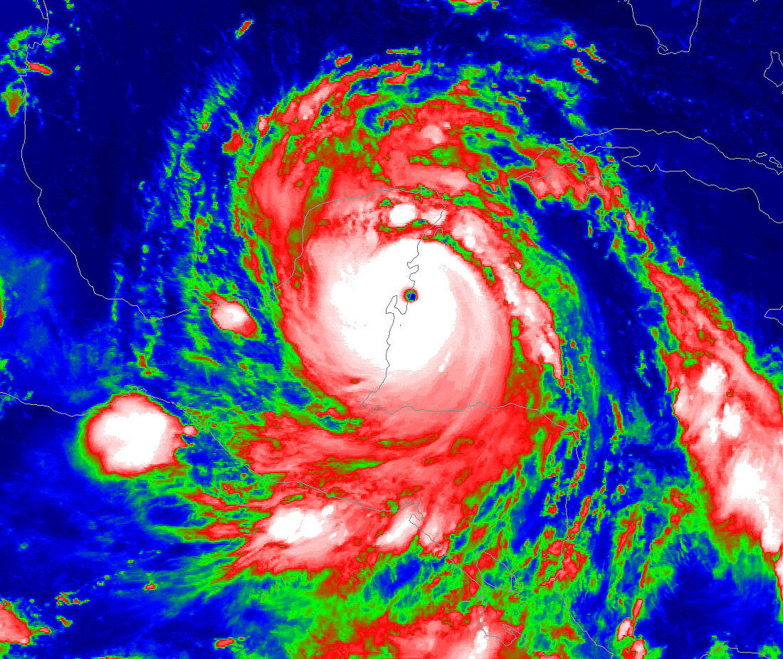
| Hurricane Dean's landfall on 21 August 2007,infrared satellite image. North is at top. The hurricane made landfall in the Costa Maya region of Mexico's Yucatan peninsula (outlined) at 03:15 local time. The image is colour-coded,with the most destructive central part of the hurricane (white) surrounded by weaker storm clouds (red,green and blue). The hurricane was a Category 5,the first Atlantic hurricane to make landfall as a Category 5 since 1992. It moved in from the Caribbean (right),bringing winds of over 250 kilometres per hour and widespread flooding. The eye impacted a sparsely populated area,missing the major tourist resort of Cancun to the north. Image obtained by NOAA's GOES-12 satellite | |
| Lizenzart: | Lizenzpflichtig |
| Credit: | Science Photo Library / NOAA |
| Bildgröße: | 1141 px × 960 px |
| Modell-Rechte: | nicht erforderlich |
| Eigentums-Rechte: | nicht erforderlich |
| Restrictions: |
|
Preise für dieses Bild ab 15 €
Universitäten & Organisationen
(Informationsmaterial Digital, Informationsmaterial Print, Lehrmaterial Digital etc.)
ab 15 €
Redaktionell
(Bücher, Bücher: Sach- und Fachliteratur, Digitale Medien (redaktionell) etc.)
ab 30 €
Werbung
(Anzeigen, Aussenwerbung, Digitale Medien, Fernsehwerbung, Karten, Werbemittel, Zeitschriften etc.)
ab 55 €
Handelsprodukte
(bedruckte Textilie, Kalender, Postkarte, Grußkarte, Verpackung etc.)
ab 75 €
Pauschalpreise
Rechtepakete für die unbeschränkte Bildnutzung in Print oder Online
ab 495 €