Hurricane Dean,infrared satellite image
Bildnummer 11738086
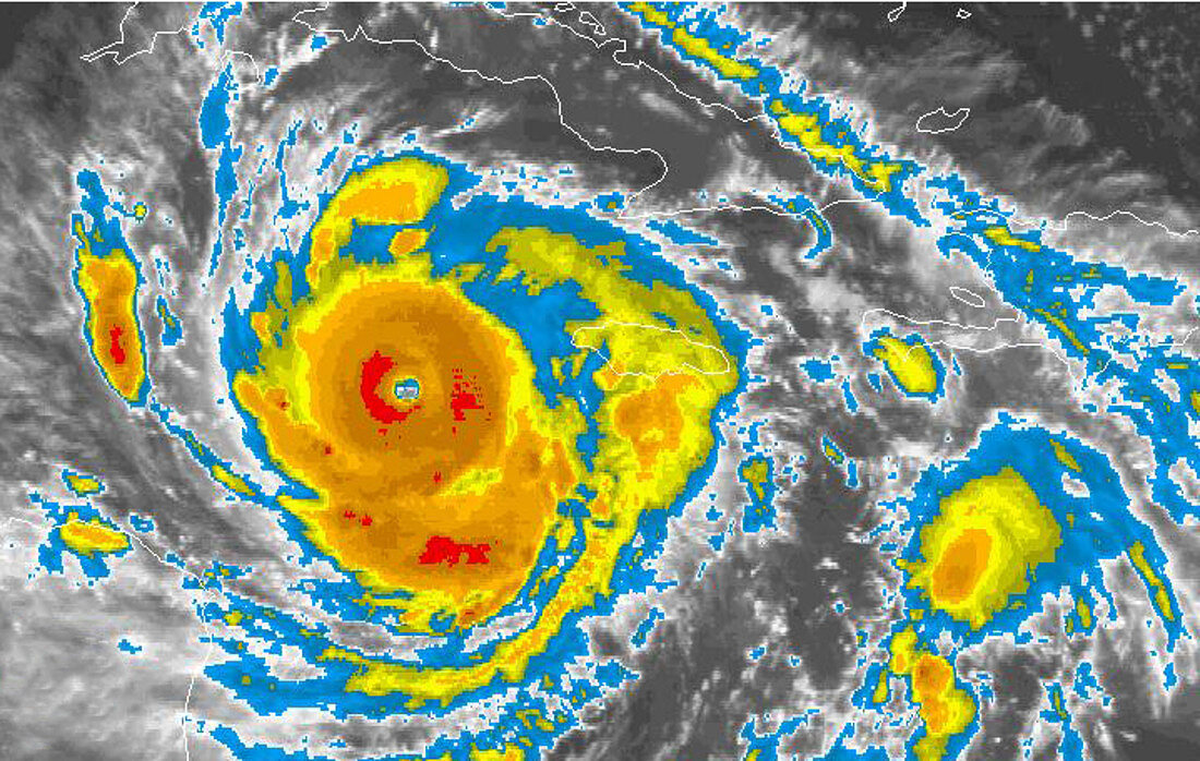
| Hurricane Dean,infrared satellite image,obtained at 08:45 local time on 20 August 2007 as it passed through the Caribbean,moving from right to left. North is at top. The islands of Cuba (across top) and Jamaica (centre) are outlined in white. The image is colour-coded for intensity of reflected infrared. A dense mass of cloud (orange) is seen rotating around the eye of the hurricane (centre left). Since 17 August,Hurricane Dean had been a category 4 hurricane with wind speeds of up to 230 kilometres per hour,and a diameter of hundreds of kilometres. On 19 August,it passed just south of Jamaica,causing severe damage. Image obtained by NOAA's Geostationary Operational Environmental Satellite (GOES) | |
| Lizenzart: | Lizenzpflichtig |
| Credit: | Science Photo Library / NOAA |
| Bildgröße: | 719 px × 456 px |
| Modell-Rechte: | nicht erforderlich |
| Eigentums-Rechte: | nicht erforderlich |
| Restrictions: |
|
Preise für dieses Bild ab 15 €
Universitäten & Organisationen
(Informationsmaterial Digital, Informationsmaterial Print, Lehrmaterial Digital etc.)
ab 15 €
Redaktionell
(Bücher, Bücher: Sach- und Fachliteratur, Digitale Medien (redaktionell) etc.)
ab 30 €
Werbung
(Anzeigen, Aussenwerbung, Digitale Medien, Fernsehwerbung, Karten, Werbemittel, Zeitschriften etc.)
ab 55 €
Handelsprodukte
(bedruckte Textilie, Kalender, Postkarte, Grußkarte, Verpackung etc.)
ab 75 €
Pauschalpreise
Rechtepakete für die unbeschränkte Bildnutzung in Print oder Online
ab 495 €
Keywords
- 21. Jahrhundert,
- Atlantisch,
- Auge,
- August,
- Erdbeobachtung,
- extrem,
- farbcodiert,
- Farbe,
- Hurrikan,
- infrarot,
- ir,
- Jamaika,
- Karibik,
- Kategorie 4,
- Klima,
- Kuba,
- Meer,
- Meteorologie,
- meteorologisch,
- NOAA,
- Nordamerika,
- nordamerikanisch,
- Ozean,
- rotierend,
- Satellit,
- Satellitenbild,
- Tropisch,
- Weltall,
- Wetter,
- Wolke,
- Wolken