Hurricane Emily,14th July 2005
Bildnummer 11738037
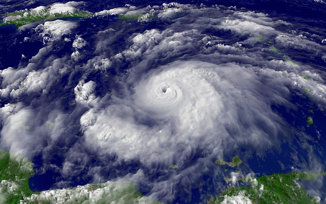
| Hurricane Emily in the Caribbean Sea,at 19:15 GMT (20:15 BST) on 14th July 2005. At this stage Emily was a category four hurricane,the second strongest level,with winds of over 220 kilometres per hour. Emily battered the island of Grenada (just below centre at right) on the 14th before heading towards Jamaica (out of frame at top left). At top left is Hispaniola,divided into Haiti (left) and the Dominican Republic (right). At top centre is Puerto Rico,and the islands of the West Indies arc from top to bottom right. Emily is the second strong hurricane of the unusually early 2005 season,after Dennis the week before. Imaged by the GOES-12 satellite | |
| Lizenzart: | Lizenzpflichtig |
| Credit: | Science Photo Library / NASA |
| Bildgröße: | 1920 px × 1200 px |
| Modell-Rechte: | nicht erforderlich |
| Eigentums-Rechte: | nicht erforderlich |
| Restrictions: | - |
Preise für dieses Bild ab 15 €
Universitäten & Organisationen
(Informationsmaterial Digital, Informationsmaterial Print, Lehrmaterial Digital etc.)
ab 15 €
Redaktionell
(Bücher, Bücher: Sach- und Fachliteratur, Digitale Medien (redaktionell) etc.)
ab 30 €
Werbung
(Anzeigen, Aussenwerbung, Digitale Medien, Fernsehwerbung, Karten, Werbemittel, Zeitschriften etc.)
ab 55 €
Handelsprodukte
(bedruckte Textilie, Kalender, Postkarte, Grußkarte, Verpackung etc.)
ab 75 €
Pauschalpreise
Rechtepakete für die unbeschränkte Bildnutzung in Print oder Online
ab 495 €
Keywords
- 21. Jahrhundert,
- einer,
- Emily,
- Erdbeobachtung,
- extrem,
- Hurrikan,
- Jahreszeiten,
- Juli,
- Karibisches Meer,
- Klimatologie,
- klimatologisch,
- Meteorologie,
- meteorologisch,
- Puerto Rico,
- Satellit,
- Satellitenbild,
- Single,
- Spiral,
- Spirale,
- spiralförmig,
- Venezuela,
- Weltall,
- Westindische Inseln,
- Wetter,
- Wolke,
- Wolken