South-East England
Bildnummer 11736248
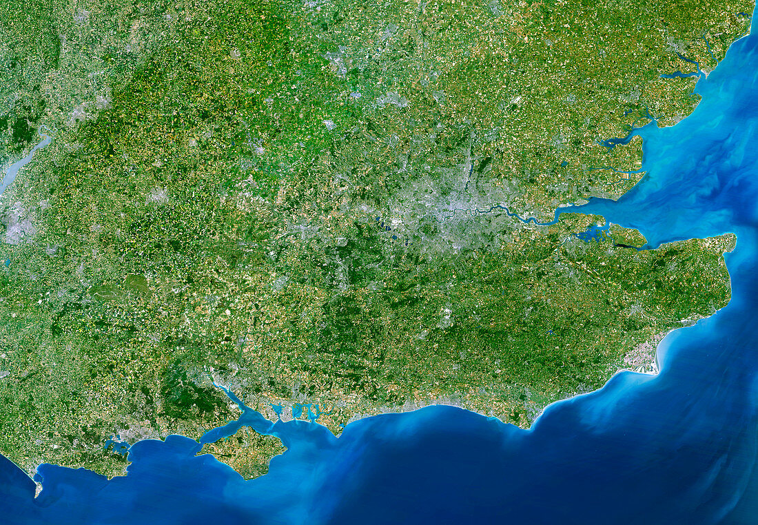
| South-East England,satellite image. North is at top. This view is about 280 kilometres across,stretching from Bristol (grey area,centre left) to the eastern coast of Kent (far right). London,the capital city of the UK,is the large grey area at centre right,to the left of the Thames Estuary (light blue). From south-north,the view covers about 210 kilometres,from the Isle of Wight (lower left) to Northampton (left of top centre). Other geographical features seen include part of the Severn Estuary (grey-blue,above Bristol) and the urbanised stretches of the south coast from Bournemouth in the west to Brighton in the east. Outside the cities,a patchwork of fields is seen covering much of the countryside | |
| Lizenzart: | Lizenzpflichtig |
| Credit: | Science Photo Library / Planetobserver |
| Bildgröße: | 5500 px × 3809 px |
| Modell-Rechte: | nicht erforderlich |
| Eigentums-Rechte: | nicht erforderlich |
| Restrictions: | - |
Preise für dieses Bild ab 15 €
Universitäten & Organisationen
(Informationsmaterial Digital, Informationsmaterial Print, Lehrmaterial Digital etc.)
ab 15 €
Redaktionell
(Bücher, Bücher: Sach- und Fachliteratur, Digitale Medien (redaktionell) etc.)
ab 30 €
Werbung
(Anzeigen, Aussenwerbung, Digitale Medien, Fernsehwerbung, Karten, Werbemittel, Zeitschriften etc.)
ab 55 €
Handelsprodukte
(bedruckte Textilie, Kalender, Postkarte, Grußkarte, Verpackung etc.)
ab 75 €
Pauschalpreise
Rechtepakete für die unbeschränkte Bildnutzung in Print oder Online
ab 495 €
Keywords
- 21. Jahrhundert,
- Bristol,
- britisch,
- Britische Inseln,
- Bucht,
- Buchten,
- England,
- Erdbeobachtung,
- Europa,
- europäisch,
- Feld,
- Felder,
- Fluss,
- Flüsse,
- geografisch,
- Geographie,
- Großbritannien,
- Insel,
- Kanal,
- Kent,
- Küste,
- Küsten-,
- Land,
- Landwirtschaft,
- landwirtschaftlich,
- London,
- Meer,
- Mündung,
- Nation,
- Ozean,
- Satellit,
- Satellitenbild,
- Stadt,
- Städte,
- Süd-,
- Süden,
- Südküste,
- Südostengland,
- Themse,
- Urbanisierung,
- Vereinigtes Königreich,
- Weltall