Burma,satellite image,April 2008
Bildnummer 11736158
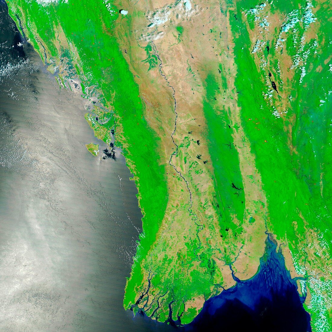
| Burma,TERRA satellite image,on the 15th April 2008. The Bay of Bengal is at left. Water is blue to black,vegetation is green,bare ground is brown and clouds are white. At bottom centre are the numerous distributaries of the Irrawaddy river,known as the Mouths of the Irrawaddy. On 2nd May 2008tropical cyclone Nargis made landfall across the distributaries,causing widespread flooding,destroying thousands of buildings and killing tens of thousands of people. For an image of this area after the cyclone hit see E158/281 | |
| Lizenzart: | Lizenzpflichtig |
| Credit: | Science Photo Library / NASA |
| Bildgröße: | 2965 px × 2965 px |
| Modell-Rechte: | nicht erforderlich |
| Eigentums-Rechte: | nicht erforderlich |
| Restrictions: | - |
Preise für dieses Bild ab 15 €
Universitäten & Organisationen
(Informationsmaterial Digital, Informationsmaterial Print, Lehrmaterial Digital etc.)
ab 15 €
Redaktionell
(Bücher, Bücher: Sach- und Fachliteratur, Digitale Medien (redaktionell) etc.)
ab 30 €
Werbung
(Anzeigen, Aussenwerbung, Digitale Medien, Fernsehwerbung, Karten, Werbemittel, Zeitschriften etc.)
ab 55 €
Handelsprodukte
(bedruckte Textilie, Kalender, Postkarte, Grußkarte, Verpackung etc.)
ab 75 €
Pauschalpreise
Rechtepakete für die unbeschränkte Bildnutzung in Print oder Online
ab 495 €