Coloured 8th century Turin Map of the world
Bildnummer 11735491
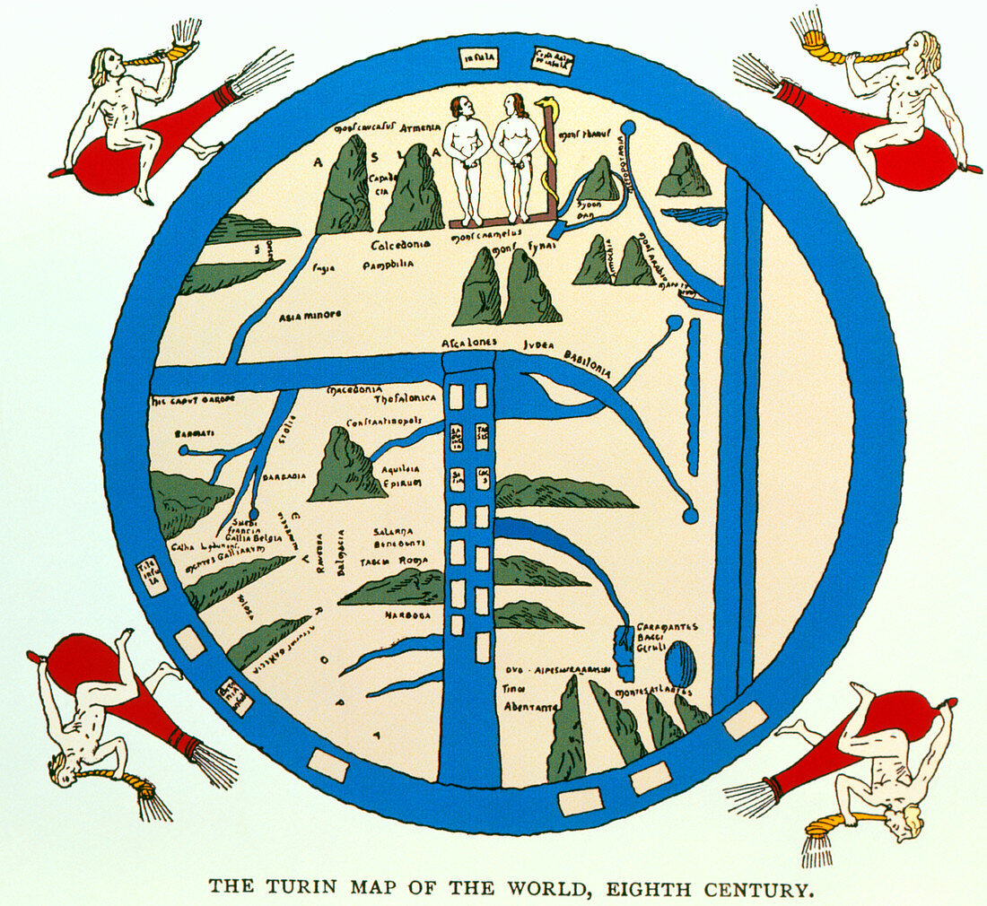
| 8th century world map. Coloured 8th century world map known as the Turin Map of the world. The map shows Adam and Eve (upper centre),the world's first human inhabitants (according to the Bible),standing on top of the world. The world is surrounded by the blue ocean and the four winds (figures blowing horns). The three continents known at that time are shown in the map: Europe (lower left),Asia (where Adam & Eve are standing),and Africa (lower right). Britain and Scotland are islands in the encircling sea just outside Europe. This image is from A Book of Discovery by M.B. Synge | |
| Lizenzart: | Lizenzpflichtig |
| Credit: | Science Photo Library / Terry, Sheila |
| Bildgröße: | 3307 px × 3035 px |
| Modell-Rechte: | nicht erforderlich |
| Eigentums-Rechte: | nicht erforderlich |
| Restrictions: | - |
Preise für dieses Bild ab 15 €
Universitäten & Organisationen
(Informationsmaterial Digital, Informationsmaterial Print, Lehrmaterial Digital etc.)
ab 15 €
Redaktionell
(Bücher, Bücher: Sach- und Fachliteratur, Digitale Medien (redaktionell) etc.)
ab 30 €
Werbung
(Anzeigen, Aussenwerbung, Digitale Medien, Fernsehwerbung, Karten, Werbemittel, Zeitschriften etc.)
ab 55 €
Handelsprodukte
(bedruckte Textilie, Kalender, Postkarte, Grußkarte, Verpackung etc.)
ab 75 €
Pauschalpreise
Rechtepakete für die unbeschränkte Bildnutzung in Print oder Online
ab 495 €