Earth's topography
Bildnummer 11735291
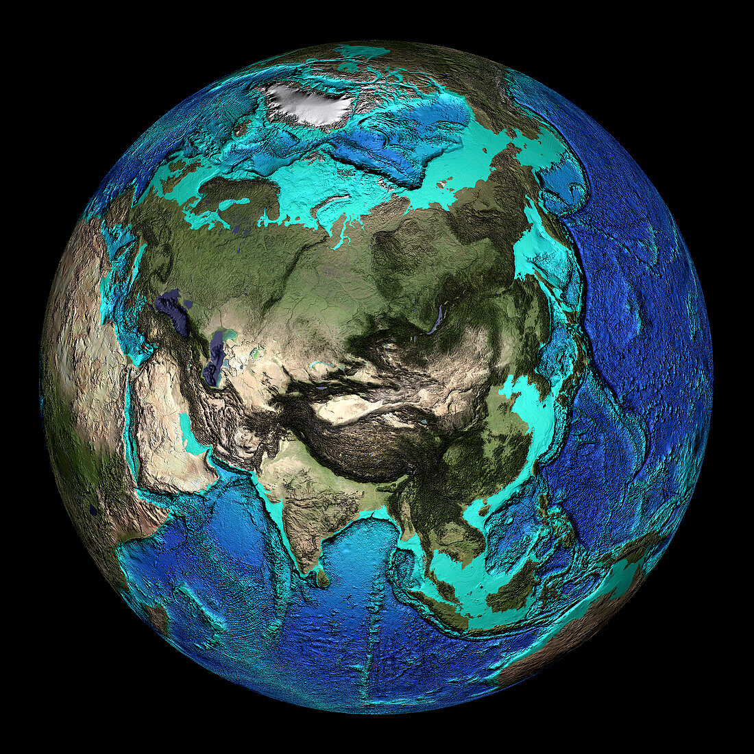
| Global topography. Topographical map of the Earth,centred on 45 degrees North,90 degrees East. The seas and oceans are colour-coded by depth. Turquoise regions descend to around 150 metres,and show the continental shelf. This drops off abruptly at the shelf break,where the continental slope descends to the deep ocean floor (seen as increasingly dark shades of blue). Land colours are based on MODIS true-colour data from the Terra satellite in 2004. Highlands are seen as darker regions,notably the Himalaya mountain range (centre),which contains Mount Everest,the highest point on Earth,at 8848 metres above sea level. The lowest point is in the Mariana Trench (at the lower edge of the dark arc at centre right),some 10,900 metres below sea level | |
| Lizenzart: | Lizenzpflichtig |
| Credit: | Science Photo Library / NOAA |
| Bildgröße: | 3500 px × 3500 px |
| Modell-Rechte: | nicht erforderlich |
| Eigentums-Rechte: | nicht erforderlich |
| Restrictions: |
|
Preise für dieses Bild ab 15 €
Universitäten & Organisationen
(Informationsmaterial Digital, Informationsmaterial Print, Lehrmaterial Digital etc.)
ab 15 €
Redaktionell
(Bücher, Bücher: Sach- und Fachliteratur, Digitale Medien (redaktionell) etc.)
ab 30 €
Werbung
(Anzeigen, Aussenwerbung, Digitale Medien, Fernsehwerbung, Karten, Werbemittel, Zeitschriften etc.)
ab 55 €
Handelsprodukte
(bedruckte Textilie, Kalender, Postkarte, Grußkarte, Verpackung etc.)
ab 75 €
Pauschalpreise
Rechtepakete für die unbeschränkte Bildnutzung in Print oder Online
ab 495 €
Keywords
- Asiatisch,
- Asien,
- australisch,
- Bathymetrie,
- Berge,
- Bergkette,
- Bild,
- Bilder,
- britisch,
- Erde,
- Erdkunde,
- Foto,
- Fotos,
- ganze Erde,
- geografisch,
- Geographie,
- Globus,
- Himalaya,
- Indischer Ozean,
- Kontinent,
- Kreis,
- kreisförmig,
- Meeresboden,
- Meereskunde,
- modis,
- nordamerikanisch,
- Ozean,
- Planet,
- rund,
- Satellitenbild,
- Südamerikanisch,
- Südostasien,
- Terra,
- topografisch,
- Topographie,
- topographisch,
- Weltall,
- weltweit,
- Wissenschaften