Earth's topography
Bildnummer 11735290
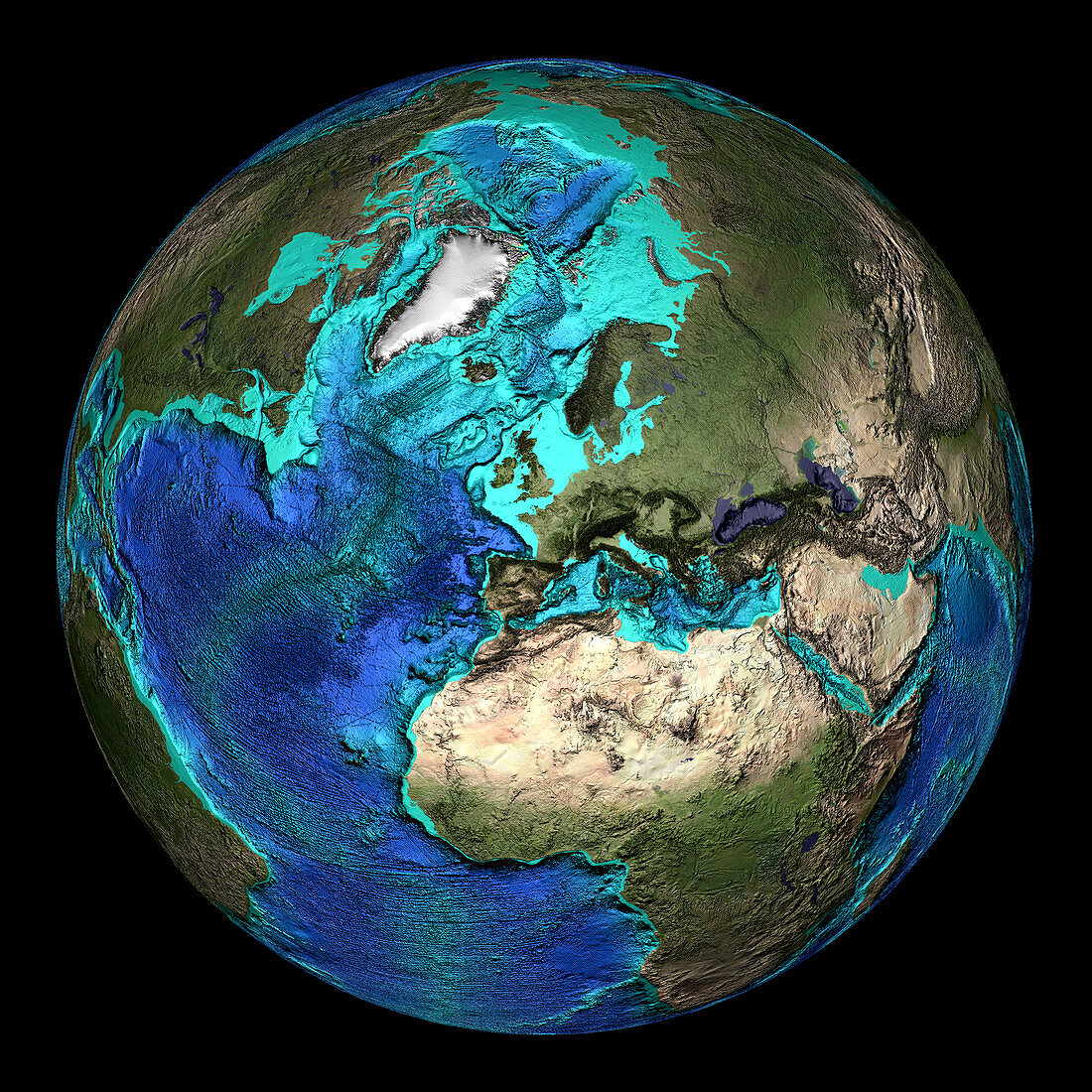
| Global topography. Topographical map of the Earth,centred on 45 degrees North,0 degrees East. The seas and oceans are colour-coded by depth. Turquoise regions descend to around 150 metres,and show the continental shelf. This drops off abruptly at the shelf break,where the continental slope descends to the deep ocean floor (seen as increasingly dark shades of blue). The mid- Atlantic Ridge extends north-south the length of the Atlantic Ocean,passing through Iceland (upper centre). Land colours are based on MODIS true- colour data from the Terra satellite in 2004. Highlands are seen as darker regions | |
| Lizenzart: | Lizenzpflichtig |
| Credit: | Science Photo Library / NOAA |
| Bildgröße: | 3500 px × 3500 px |
| Modell-Rechte: | nicht erforderlich |
| Eigentums-Rechte: | nicht erforderlich |
| Restrictions: |
|
Preise für dieses Bild ab 15 €
Universitäten & Organisationen
(Informationsmaterial Digital, Informationsmaterial Print, Lehrmaterial Digital etc.)
ab 15 €
Redaktionell
(Bücher, Bücher: Sach- und Fachliteratur, Digitale Medien (redaktionell) etc.)
ab 30 €
Werbung
(Anzeigen, Aussenwerbung, Digitale Medien, Fernsehwerbung, Karten, Werbemittel, Zeitschriften etc.)
ab 55 €
Handelsprodukte
(bedruckte Textilie, Kalender, Postkarte, Grußkarte, Verpackung etc.)
ab 75 €
Pauschalpreise
Rechtepakete für die unbeschränkte Bildnutzung in Print oder Online
ab 495 €
Keywords
- Afrika,
- Afrikanisch,
- Atlantischer Ozean,
- australisch,
- Bathymetrie,
- Bild,
- Bilder,
- britisch,
- Erde,
- Erdkunde,
- Europa,
- europäisch,
- Foto,
- Fotos,
- ganze Erde,
- geografisch,
- Geographie,
- Globus,
- Großbritannien,
- Kontinent,
- Kreis,
- kreisförmig,
- Meeresboden,
- Meereskunde,
- Mittelmeer,
- modis,
- nordamerikanisch,
- Ozean,
- Planet,
- rund,
- Satellitenbild,
- Südamerikanisch,
- Terra,
- topografisch,
- Topographie,
- topographisch,
- Vereinigtes Königreich,
- Weltall,
- weltweit,
- Wissenschaften