Low pressure system off of Ireland
Bildnummer 11726916
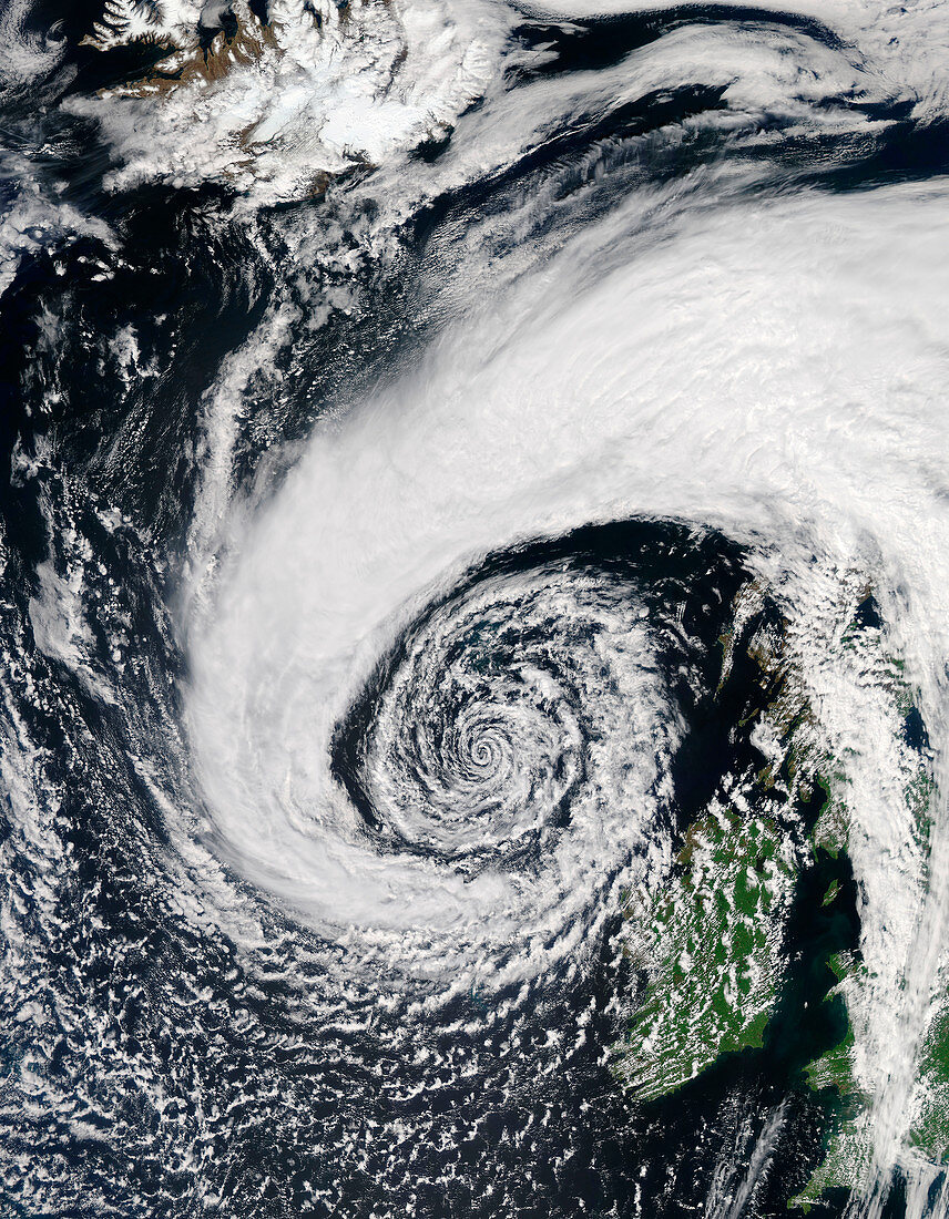
| True-colour satellite image of a very deep low pressure system just off the northwestern coast of Ireland on 5th June 2015. Bands of cloud,containing rain and thunderstorms,swirl into the centre of the low,and extend over the British Isles. Image captured by the MODIS (Moderate Resolution Imaging Spectroradiometer) instrument on NASA's Aqua satellite | |
| Lizenzart: | Lizenzpflichtig |
| Credit: | Science Photo Library / Jeff Schmaltz, MODIS Land Rapid Response Team, NASA GSFC |
| Bildgröße: | 4677 px × 6013 px |
| Modell-Rechte: | nicht erforderlich |
| Eigentums-Rechte: | nicht erforderlich |
| Restrictions: | - |
Preise für dieses Bild ab 15 €
Universitäten & Organisationen
(Informationsmaterial Digital, Informationsmaterial Print, Lehrmaterial Digital etc.)
ab 15 €
Redaktionell
(Bücher, Bücher: Sach- und Fachliteratur, Digitale Medien (redaktionell) etc.)
ab 30 €
Werbung
(Anzeigen, Aussenwerbung, Digitale Medien, Fernsehwerbung, Karten, Werbemittel, Zeitschriften etc.)
ab 55 €
Handelsprodukte
(bedruckte Textilie, Kalender, Postkarte, Grußkarte, Verpackung etc.)
ab 75 €
Pauschalpreise
Rechtepakete für die unbeschränkte Bildnutzung in Print oder Online
ab 495 €