Environmental remote sensing system
Bildnummer 11725079
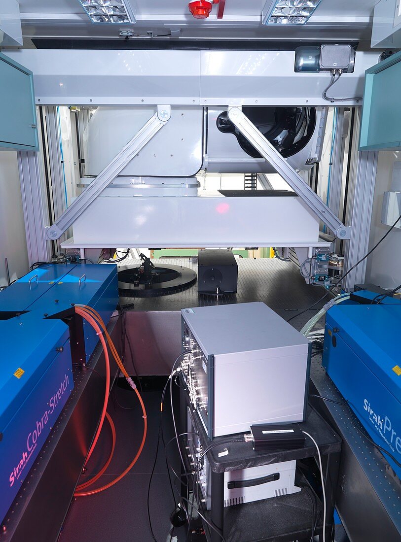
| Environmental remote sensing system. Interior of a portable laboratory used to house the Differential Absorption Lidar (DIAL) instrumentation for use as an environmental remote sensing system. A lidar system uses lasers (left and right) to measure and analyse targets,in this case chemicals in the Earth's atmosphere. Differential absorption lidar is used to measure atmospheric concentrations of gases such as water vapour and ozone,for use in meteorological and climatological studies. Photographed in 2014,at the National Physical Laboratory,Teddington,UK | |
| Lizenzart: | Lizenzpflichtig |
| Credit: | Science Photo Library / Brookes, Andrew / National Physical Laboratory |
| Bildgröße: | 4153 px × 5621 px |
| Modell-Rechte: | nicht erforderlich |
| Eigentums-Rechte: | nicht erforderlich |
| Restrictions: | - |
Preise für dieses Bild ab 15 €
Universitäten & Organisationen
(Informationsmaterial Digital, Informationsmaterial Print, Lehrmaterial Digital etc.)
ab 15 €
Redaktionell
(Bücher, Bücher: Sach- und Fachliteratur, Digitale Medien (redaktionell) etc.)
ab 30 €
Werbung
(Anzeigen, Aussenwerbung, Digitale Medien, Fernsehwerbung, Karten, Werbemittel, Zeitschriften etc.)
ab 55 €
Handelsprodukte
(bedruckte Textilie, Kalender, Postkarte, Grußkarte, Verpackung etc.)
ab 75 €
Pauschalpreise
Rechtepakete für die unbeschränkte Bildnutzung in Print oder Online
ab 495 €
Keywords
- 2014,
- 21. Jahrhundert,
- Atmosphäre,
- Ausrüstung,
- britisch,
- chemisch,
- England,
- Englisch,
- Europa,
- europäisch,
- Fahrzeug,
- Forschung,
- Gase,
- Großbritannien,
- Klimatologie,
- klimatologisch,
- Labor,
- Laser,
- Maschine,
- Meteorologie,
- meteorologisch,
- National Physical Laboratory,
- Niemand,
- NPL,
- Physik,
- Technologie,
- technologisch,
- Teddington,
- Tragbar,
- Umweltwissenschaften,
- Van,
- Vereinigtes Königreich,
- Wasserdampf,
- Wetter