Amundsen Gulf sea ice coverage,June 2015
Bildnummer 11716811
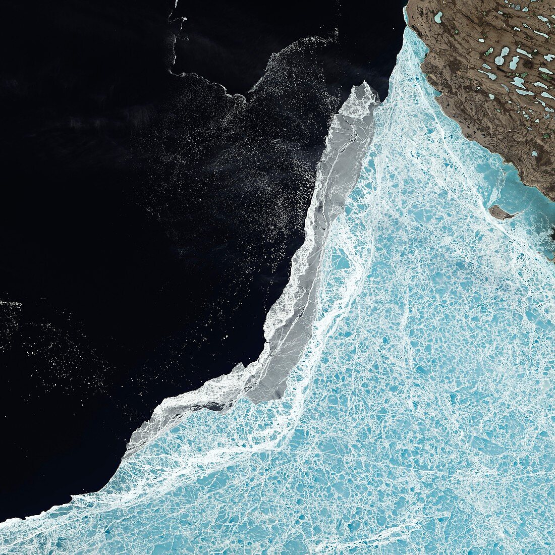
| Amundsen Gulf sea ice coverage,June 2015. Satellite image showing sea ice edge in the Amundsen Gulf,between Victoria Island and mainland Canada,on 21st June 2015. The gulf forms part of the Northwest Passage,which opened during the low-ice year of 2007 but remained ice-bound in 2014. The summer of 2014 began with relatively cool temperatures in the Arctic and the storms and winds that can break up ice were mostly absent. However,the long-term thinning of sea ice has made it more susceptible to melting,so the 2014 melt season concluded with the sixth-lowest ice extent of the modern satellite era (shown here). Seen here are a range of sea ice types: blue ice (lower right) is thicker ice that is several years old and contains fewer pockets of air that | |
| Lizenzart: | Lizenzpflichtig |
| Credit: | Science Photo Library / NASA |
| Bildgröße: | 4179 px × 4179 px |
| Modell-Rechte: | nicht erforderlich |
| Eigentums-Rechte: | nicht erforderlich |
| Restrictions: | - |
Preise für dieses Bild ab 15 €
Universitäten & Organisationen
(Informationsmaterial Digital, Informationsmaterial Print, Lehrmaterial Digital etc.)
ab 15 €
Redaktionell
(Bücher, Bücher: Sach- und Fachliteratur, Digitale Medien (redaktionell) etc.)
ab 30 €
Werbung
(Anzeigen, Aussenwerbung, Digitale Medien, Fernsehwerbung, Karten, Werbemittel, Zeitschriften etc.)
ab 55 €
Handelsprodukte
(bedruckte Textilie, Kalender, Postkarte, Grußkarte, Verpackung etc.)
ab 75 €
Pauschalpreise
Rechtepakete für die unbeschränkte Bildnutzung in Print oder Online
ab 495 €
Keywords
- 1,
- 2015,
- 21. Jahrhundert,
- Alt,
- älter,
- Arktis,
- Dick,
- Dünn,
- Eis,
- eisig,
- Erdbeobachtung,
- Gefroren,
- geografisch,
- Globale Erwärmung,
- Jung,
- jünger,
- Kalt,
- Kanada,
- Kanadisch,
- Klimatologie,
- klimatologisch,
- Klimawandel,
- Landform,
- landsat 8 Satellit,
- Meereis,
- Meteorologie,
- meteorologisch,
- Niedrig,
- Niemand,
- Nordamerika,
- nordamerikanisch,
- oli,
- Schnee,
- schneebedeckt,
- Sommer,
- Umwelt,
- Umweltwissenschaften,
- Wasser,
- Weltall,
- Wetter