North America at night
Bildnummer 11697796
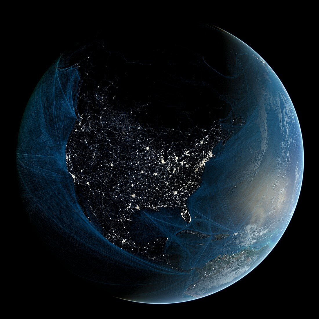
| North America at night. Map showing urban and industrial lights over North America at night. It was created by combining data from NASA's Moderate Resolution Imaging Spectroradiometer (MODIS) aboard the Terra satellite. Most lights originate from artificial lighting in cities and towns,other light sources originate from biomass burning,such as fires and oil rig flares. The image also shows shipping routes superimposed over the Atlantic and Pacific Oceans. Data acquired from NOAA's SEAS BBXX database,from 14.10.2004 to 15.10.2005. This image illustrates modern human impact on the planet | |
| Lizenzart: | Lizenzpflichtig |
| Credit: | Science Photo Library / Pharand-Deschenes, Felix |
| Bildgröße: | 4961 px × 4961 px |
| Modell-Rechte: | nicht erforderlich |
| Eigentums-Rechte: | nicht erforderlich |
| Restrictions: | - |
Preise für dieses Bild ab 15 €
Universitäten & Organisationen
(Informationsmaterial Digital, Informationsmaterial Print, Lehrmaterial Digital etc.)
ab 15 €
Redaktionell
(Bücher, Bücher: Sach- und Fachliteratur, Digitale Medien (redaktionell) etc.)
ab 30 €
Werbung
(Anzeigen, Aussenwerbung, Digitale Medien, Fernsehwerbung, Karten, Werbemittel, Zeitschriften etc.)
ab 55 €
Handelsprodukte
(bedruckte Textilie, Kalender, Postkarte, Grußkarte, Verpackung etc.)
ab 75 €
Pauschalpreise
Rechtepakete für die unbeschränkte Bildnutzung in Print oder Online
ab 495 €
Keywords
- 21. Jahrhundert,
- Amerikanisch,
- Anthropozän,
- Arktis,
- Erdbeobachtung,
- Erde,
- geografisch,
- Geographie,
- Illustration,
- Kanada,
- Kanadisch,
- Karibik,
- Kunstwerk,
- Licht,
- menschliche Präsenz,
- modern,
- Modernität,
- modis,
- Nachtzeit,
- Nordamerika,
- Ölbohrinsel,
- Planet,
- Satellit,
- Satellitenbild,
- Spektroradiometer,
- Stadt,
- Stadt in der Nacht,
- Städte,
- Urbanisierung,
- USA,
- Vereinigte Staaten,
- Welt in der Nacht,
- Zentralamerika