Antarctic sea ice maximum,2014
Bildnummer 11694078
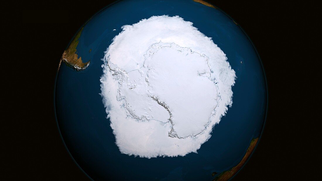
| Antarctic ice maximum extent. Satellite image showing the Antarctic polar ice cap at its annual maximum extent on 19th September 2014. The Antarctic sea ice (white with blue tint) reaches a maximum in September,at the end of the Antarctic winter. The sea ice covered 20.14 million square kilometres,the largest extent since records began in the late 1970s. Even with this increase in sea ice,globally total sea ice is still declining due to climate change. A number of conditions are thought to have influenced the increase in Antarctic sea ice,including changes in wind patterns and increased snow fall | |
| Lizenzart: | Lizenzpflichtig |
| Credit: | Science Photo Library / Cindy Starr / NASA's Scientific Visualization Studio |
| Bildgröße: | 5634 px × 3169 px |
| Modell-Rechte: | nicht erforderlich |
| Eigentums-Rechte: | nicht erforderlich |
| Restrictions: | - |
Preise für dieses Bild ab 15 €
Universitäten & Organisationen
(Informationsmaterial Digital, Informationsmaterial Print, Lehrmaterial Digital etc.)
ab 15 €
Redaktionell
(Bücher, Bücher: Sach- und Fachliteratur, Digitale Medien (redaktionell) etc.)
ab 30 €
Werbung
(Anzeigen, Aussenwerbung, Digitale Medien, Fernsehwerbung, Karten, Werbemittel, Zeitschriften etc.)
ab 55 €
Handelsprodukte
(bedruckte Textilie, Kalender, Postkarte, Grußkarte, Verpackung etc.)
ab 75 €
Pauschalpreise
Rechtepakete für die unbeschränkte Bildnutzung in Print oder Online
ab 495 €