London,infrared satellite image
Bildnummer 11649072
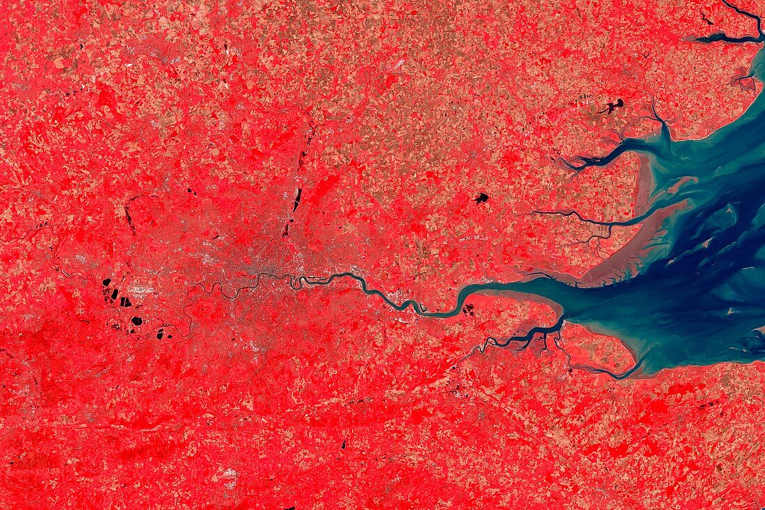
| London and its surrounds,infrared satellite image. North is at top. The Thames Estuary is at right. This view is used for studies of vegetation,as different types and densities of plants reflect infrared light in different ways. Coniferous forests appear darker red than hardwoods. Deep red hues indicate dense vegetation,while lighter reds indicate grasslands or sparsely vegetated areas. Image data obtained on 13 September 2002 by the Enhanced Thematic Mapper Plus (bands 4,3,2) on NASA's Landsat 7 satellite. For a true-colour and an alternative infrared version of this view,see images C016/3888 and C016/3890 | |
| Lizenzart: | Lizenzpflichtig |
| Credit: | Science Photo Library / USGS / ROBERT SIMMON / NASA |
| Bildgröße: | 5125 px × 3417 px |
| Modell-Rechte: | nicht erforderlich |
| Eigentums-Rechte: | nicht erforderlich |
| Restrictions: | - |
Preise für dieses Bild ab 15 €
Universitäten & Organisationen
(Informationsmaterial Digital, Informationsmaterial Print, Lehrmaterial Digital etc.)
ab 15 €
Redaktionell
(Bücher, Bücher: Sach- und Fachliteratur, Digitale Medien (redaktionell) etc.)
ab 30 €
Werbung
(Anzeigen, Aussenwerbung, Digitale Medien, Fernsehwerbung, Karten, Werbemittel, Zeitschriften etc.)
ab 55 €
Handelsprodukte
(bedruckte Textilie, Kalender, Postkarte, Grußkarte, Verpackung etc.)
ab 75 €
Pauschalpreise
Rechtepakete für die unbeschränkte Bildnutzung in Print oder Online
ab 495 €
Keywords
- 21. Jahrhundert,
- Bodennutzung,
- britisch,
- Dorf,
- England,
- Englisch,
- Erdbeobachtung,
- etm,
- etm Plus,
- Europa,
- europäisch,
- Felder,
- Flüsse,
- geografisch,
- Geographie,
- Großbritannien,
- größte,
- Hauptstadt,
- infrarot,
- ir,
- Kent,
- Küste,
- Land,
- ländlich,
- Landsat 7,
- Landschaft,
- London,
- menschliche Geografie,
- Middlesex,
- Region,
- Reihenfolge,
- Satellit,
- Satellitenbild,
- Serie,
- Stadt,
- Städte,
- städtisch,
- Südostengland,
- Surrey,
- Themse,
- Umfeld,
- Vegetation,
- Vereinigtes Königreich,
- Weltall