Artic sea ice coverage,2012
Bildnummer 11636542
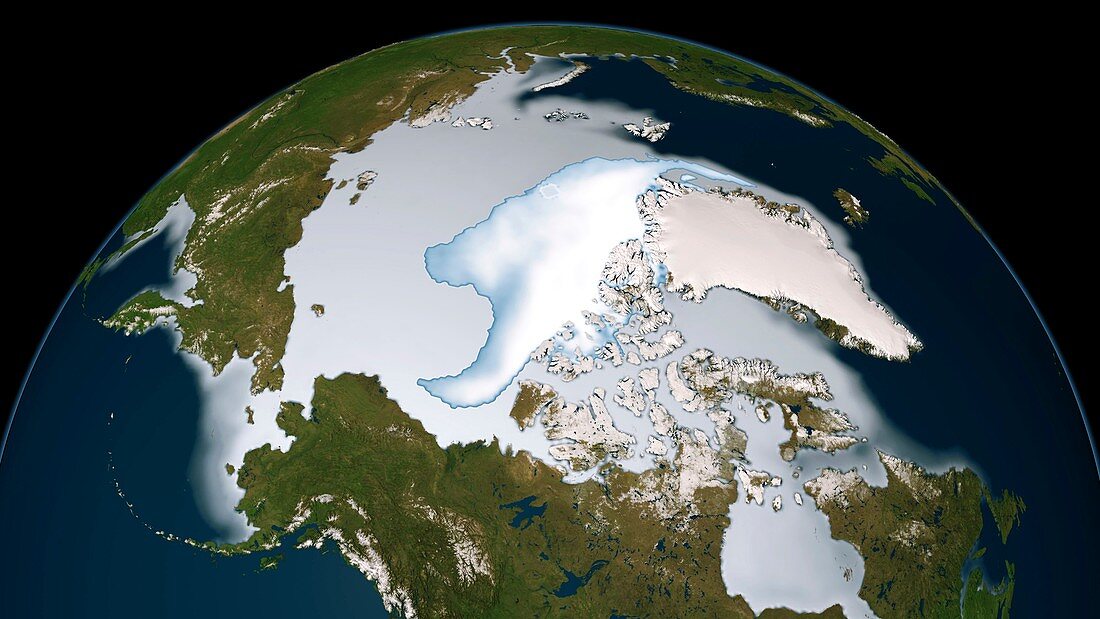
| Artic sea ice coverage,1980. Map showing the changes in Arctic sea ice coverage from 1st November 2011 to 31st January 2012. Image compiled using data from passive microwave sensors on NASA's Nimbus-7 satellite and by the Special Sensor Microwave Imager/Sounder (SSMIS) from the Defense Meteorological Satellite Program (DMSP). Multi-year ice is shown in bright white,while average sea ice cover is shown in light blue to milky white. This study found that perennial ice extent has been shrinking at a rate of -12.2 per cent per decade,while its area is declining at a rate of -13.5 per cent per decade. These numbers indicate that multiyear ice is declining faster than the perennial ice that surrounds it | |
| Lizenzart: | Lizenzpflichtig |
| Credit: | Science Photo Library / NASA |
| Bildgröße: | 3948 px × 2220 px |
| Modell-Rechte: | nicht erforderlich |
| Eigentums-Rechte: | nicht erforderlich |
| Restrictions: | - |
Preise für dieses Bild ab 15 €
Universitäten & Organisationen
(Informationsmaterial Digital, Informationsmaterial Print, Lehrmaterial Digital etc.)
ab 15 €
Redaktionell
(Bücher, Bücher: Sach- und Fachliteratur, Digitale Medien (redaktionell) etc.)
ab 30 €
Werbung
(Anzeigen, Aussenwerbung, Digitale Medien, Fernsehwerbung, Karten, Werbemittel, Zeitschriften etc.)
ab 55 €
Handelsprodukte
(bedruckte Textilie, Kalender, Postkarte, Grußkarte, Verpackung etc.)
ab 75 €
Pauschalpreise
Rechtepakete für die unbeschränkte Bildnutzung in Print oder Online
ab 495 €
Keywords
- 2011,
- 2012,
- 21. Jahrhundert,
- alljährlich,
- Arktischer Ozean,
- DMSP,
- Erdbeobachtung,
- Erde,
- geografisch,
- Geographie,
- Globale Erwärmung,
- Klimatologie,
- klimatologisch,
- Klimawandel,
- Meereis,
- Nördlicher Polarkreis,
- Ozean,
- Passage,
- Provinz,
- Region,
- Satellitenbild,
- Schmelzen,
- SSMI,
- Umwelt,
- Umweltwissenschaften,
- Verschwinden,
- Weltall