Tornado damage,Harrisburg,USA
Bildnummer 11635253
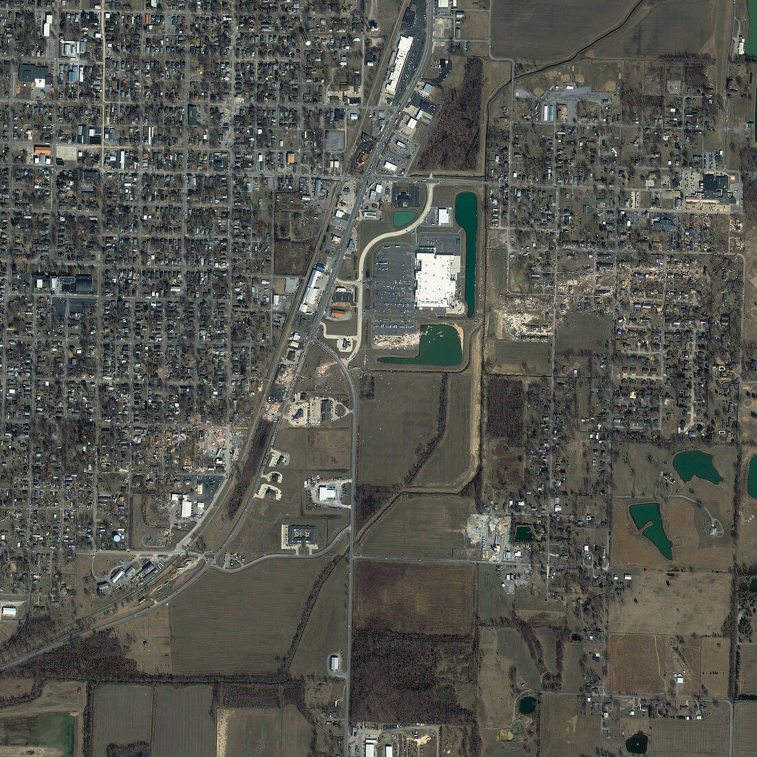
| Tornado damage. Satellite image of Harrisburg,Illinois,USA,taken on 1st March 2012,one day after a Level 4 tornado touched down. This image clearly shows the tornado's path from west to east,and the major damage to buildings,structures and other facilities,including the Harrisburg Medical Center,one of the largest health care facilities in southeastern Illinois. Imaged by the IKONOS satellite | |
| Lizenzart: | Lizenzpflichtig |
| Credit: | Science Photo Library / Geoeye |
| Bildgröße: | 3000 px × 3000 px |
| Modell-Rechte: | nicht erforderlich |
| Restrictions: | - |
Preise für dieses Bild ab 15 €
Universitäten & Organisationen
(Informationsmaterial Digital, Informationsmaterial Print, Lehrmaterial Digital etc.)
ab 15 €
Redaktionell
(Bücher, Bücher: Sach- und Fachliteratur, Digitale Medien (redaktionell) etc.)
ab 30 €
Werbung
(Anzeigen, Aussenwerbung, Digitale Medien, Fernsehwerbung, Karten, Werbemittel, Zeitschriften etc.)
ab 55 €
Handelsprodukte
(bedruckte Textilie, Kalender, Postkarte, Grußkarte, Verpackung etc.)
ab 75 €
Pauschalpreise
Rechtepakete für die unbeschränkte Bildnutzung in Print oder Online
ab 495 €
Keywords
- 2012,
- 21. Jahrhundert,
- Amerikanisch,
- Beschädigt,
- Erdbeobachtung,
- extremes Wetter,
- Gebäude,
- geografisch,
- Geographie,
- IKONOS,
- Illinois,
- Klimatologie,
- klimatologisch,
- Meteorologie,
- meteorologisch,
- Naturkatastrophe,
- Nordamerika,
- Pfad,
- Satellit,
- Satellitenbild,
- Schaden,
- Tornado,
- Umwelt,
- Umweltwissenschaften,
- uns,
- USA,
- Vereinigte Staaten,
- Weltall,
- Zerstörung,
- zestört